Pictures From My Cycle Tour Of The Western Dales

Welcome to this part of my site featuring pictures from my cycle tours of the Yorkshire Dales based on the western section of the Yorkshire Dales and part of the new coast to coast route, The Way Of The Roses now open. This new cycle route stretches approximately 170 miles long starting from the East Yorkshire seaside resort of Bridlington to the seaside resort of Morecambe in Lancashire. Pictures in the order of 1 to 7 feature the most scenic stretch of this trail both on and off road. Pictures 1 and 2 are off road sections that are not yet strictly approved as part of this trail and follow over very remote moorland, known as Pockstones Moor and as this track is very rough going, a mountain bike is recommended. Picture 3 is part of the onroad section of this trail and its location is Stump Cross Caverns and is on the B6265 Pateley Bridge to Grassington  road and is located about 2 miles west of Greenhow Hill, the highest point of the route that links Nidderdale with Wharfedale. This particular stretch of the route needs the greatest of care to be taken as it can be very busy during the hot summer holidays and at peak times of the day such as weekends. Stump Cross Caverns are underground show caves open to the public and there is a cafe serving refreshments subject to opening times. Even if you don't intent visiting the caves, the restaurant will serve you a well earned stop before descending into Wharfedale. Pictures 4 to 7 are from the Wharfedale section of this trail taking in the lovely villages of Appletreewick famous for one of the first none smoking establishments, The New Inn which is picture 4. Picture 6 is the Wharfedale village of Burnsall noted for its tidy village green and is at crossroads with this new route and The Yorkshire Dales Cycleway. Pictures in the order of 8 to 10 is the upper Wharfedale section of The Yorkshire Dales cycleway starting from the town of Grassington which is well served with teashops Pubs and overnight accommodation. This section of the route now takes in the Limestone scenery of Kilnsey Crag, a popular Yorkshire Dales beauty spot before moving further on up the Dale to the village of Kettlewell, Wharfedale's most enjoyed villages served with a Youth Hostel and a village Store. Pictures in the order of 10 to 14 is where upper Wharfedale becomes Langstrothdale and the George Inn Public House in the village of Hubberholm is the last place of civilization, particularly if you intend going northbound as you have a long hill climb on one of Yorkshires highest roads only to be greeted after the downhill climb into the Market Town of Hawes in Wensleydale which is also served with a good Youth Hostel and plenty of Pubs and Cafes. Pictures in the order of 15 to 20 feature that small Dale tucked in between Wharfedale and Malhamdale known as Littondale. It is very much similar to Swaledale for its remote location and Arncliffe is the largest village of the Dale. The Queens Arms Pub in Litton village is also noted for its friendliness and its cosy log fires during the Winter season that greet you after a cold days ride. Pictures in the order of 21 to 26 feature my rides through picturesque Malhamdale located in the south west corner of The Yorkshire Dales National Park on regional route 10, The Yorkshire Dales Cycleway and is noted for its beautiful white limestone walls dating from thousands of years ago. Malham village featured in picture 22 is the largest settlement in the Dale and like Kettlewell it is a very busy walking centre during the Summer months and weekends. Pictures 23 to 26 feature Malham Cove, another of this areas well loved beauty spots and the Malham Tarn Estate known as Yorkshires Lake District. There is another but rough bridleway route that also links the Malham Tarn Estate with Kilnsey in Wharfedale featured in picture 26 known as Mastiles Lane believed to be an old drovers road to Fountains Abbey near Ripon. Malhamdale is also dominated with several long distance walking and cycling routes, the first being the Pennine Way, a long distance walking route and the most recent Pennine Bridleway in which some sections north of The Pennines are still under development. Pictures in the order of 27 to 29 feature The western section of The Way Of the Roses and this section links Malhamdale with Ribblesdale. The market town of Settle featured in picture 29 is the main centre of Ribblesdale and also offers plenty of services such as a bike shop and no end of choice regarding Pubs and Bed and Breakfast accommodation. Pictures 27 and 28 feature the long descend into Settle from one of the highest points on the entire trail of the Way Of The Roses and there are stunning views of The Bowland Hills. This final section of the Trial is also shared with Sustrans route 68 The Pennine Cycleway and at crossroads with the Pennine Bridleway at Stockdale Lane. Picture 30 is my on road map of this tour in which I have ridden from my home town of Harrogate and if you note the points marked in yellow from 6 to 15 this is the Yorkshire Dales section of the new coast to coast route. Pictures in the order of 32 to 36 are from a short cycle tour of Wensleydale during the mid Spring of 2011. Wensleydale is the most busiest of the Northern Yorkshire Dales and is best avoided during the peak seasons as even the the miner roads can be unbelievable very busy. The A684 through the dale is also the mid Transpennine route and should also be avoided at peak times as traffic can be very heavy. Unfortunately this road or the B6255 West of Hawes has to be used if you wish to visit Dentdale or go further west to the Lake District and extreme care must be exercised such as being on the lookout for hidden dips and other traffic hazards. Also single file ridding is recommended. More on The Market Town Of Hawes and Wensleydale can be found on my following link Pictures From My Visits Of Wensleydale.               

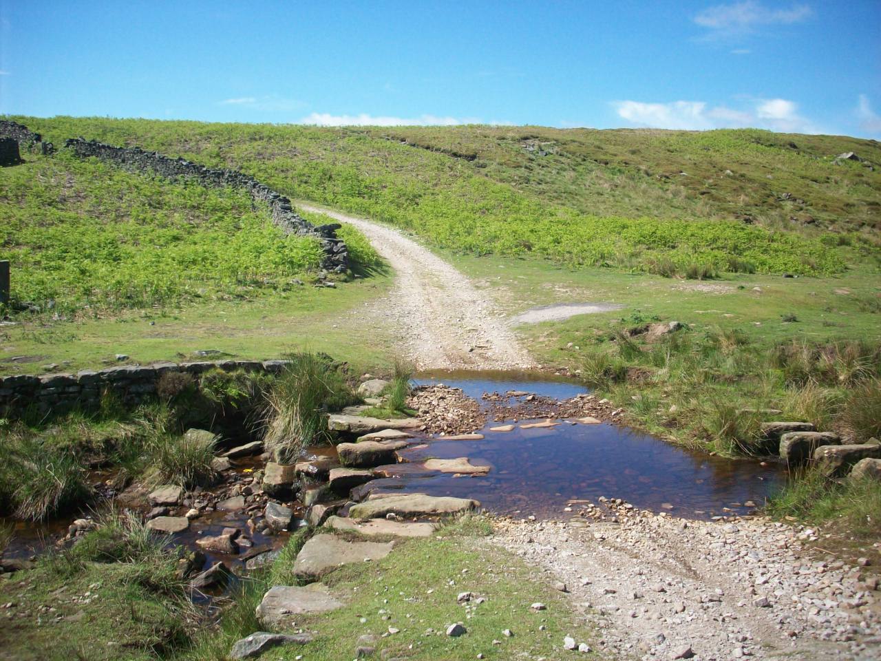
Hardengill Beck. The off road alternative cycle route over Pock Stones Moor which links the new Way Of The Roses coast to coast trail.

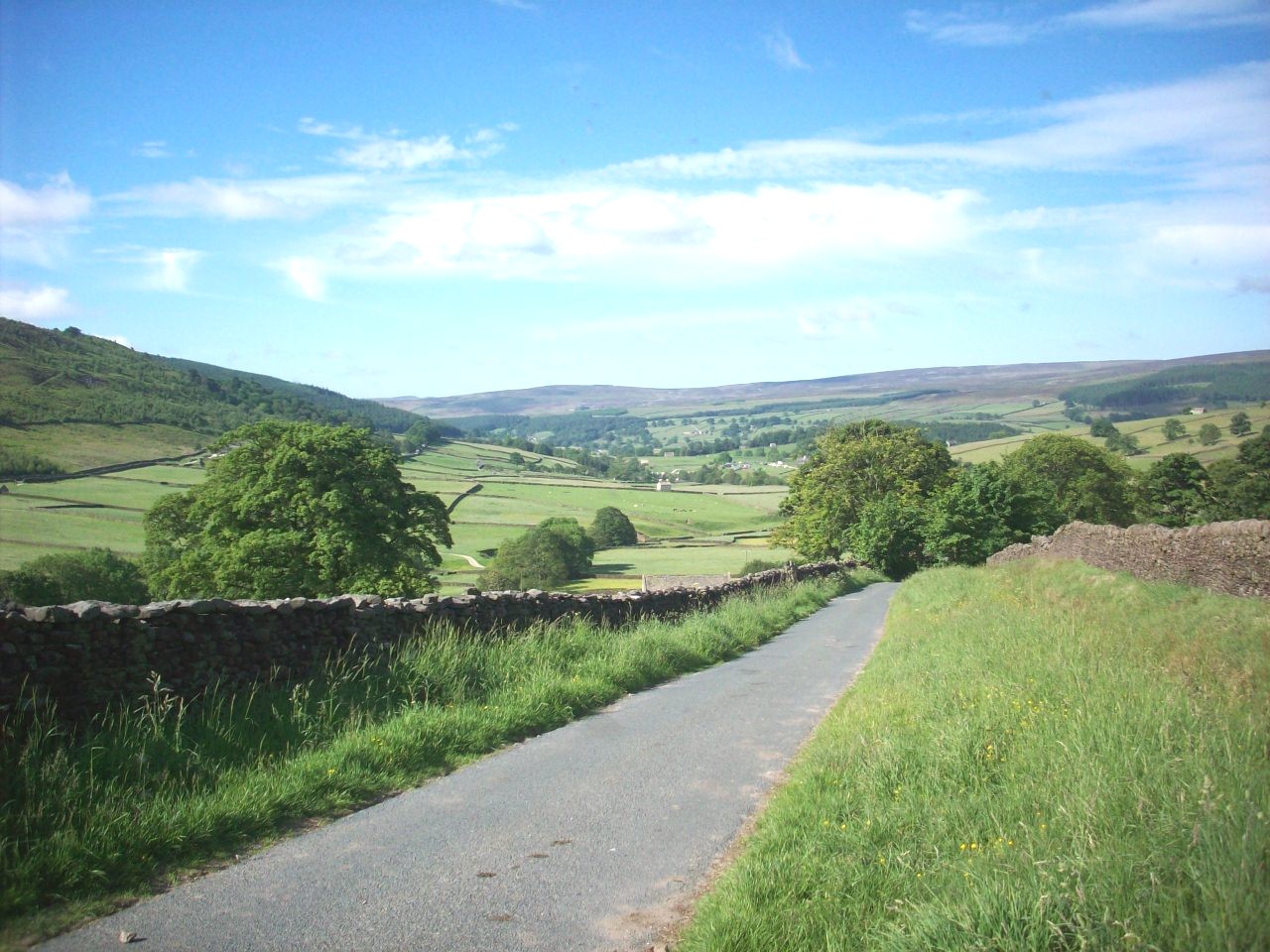
This scene is where you join The Way Of The Roses cycle route 688 at Skyreholme and is a grand view of Appletreewick Moor in Wharfedale.

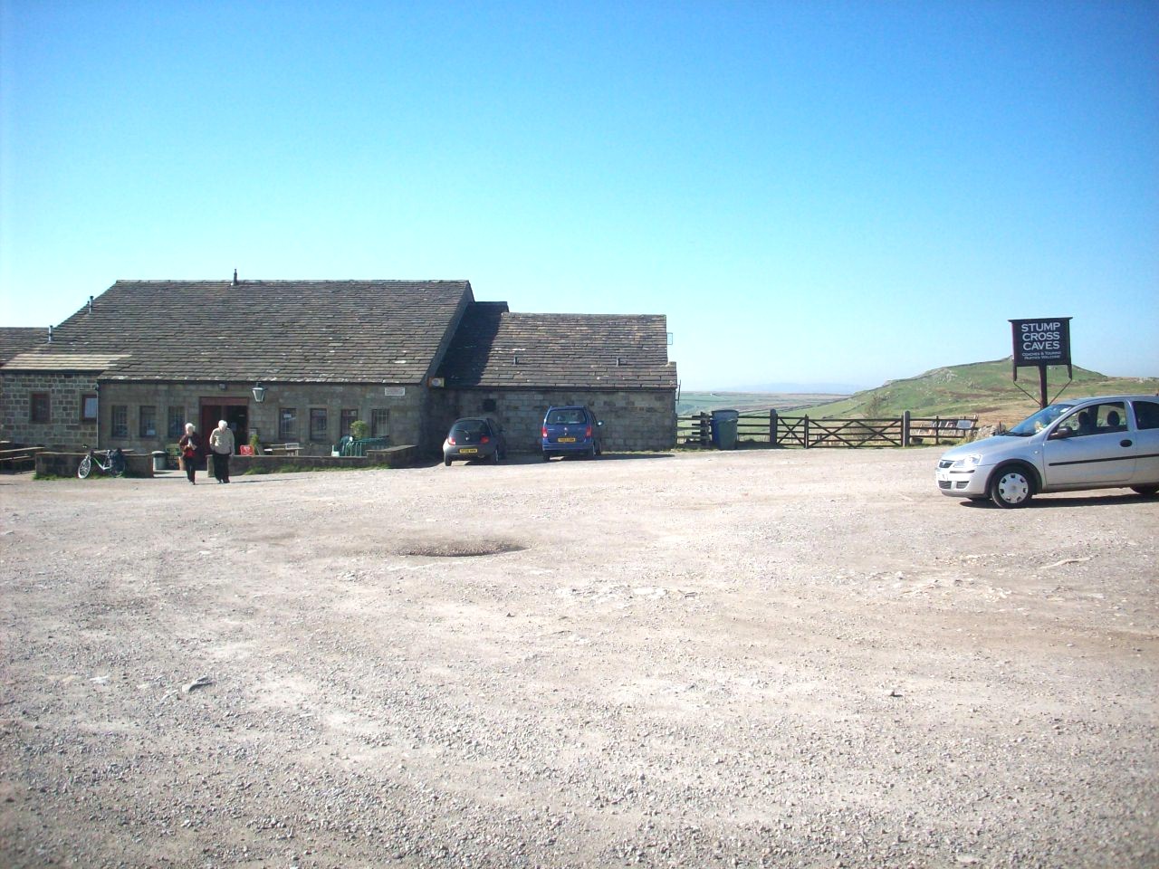
Stump Cross Caverns. Situated 2 miles west of Greenhow Hill as you go down into Wharfedale. This is the on road section of The Way Of The Roses route

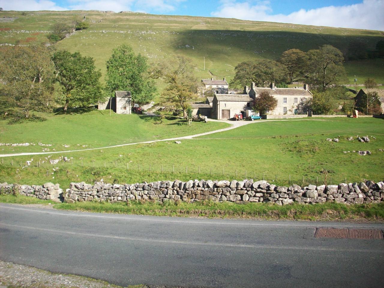
Appletreewick. Situated in Wharfedale on The Way Of The Roses route. As for a small village with 2 Pubs and a Campsite it provides good hospitality.

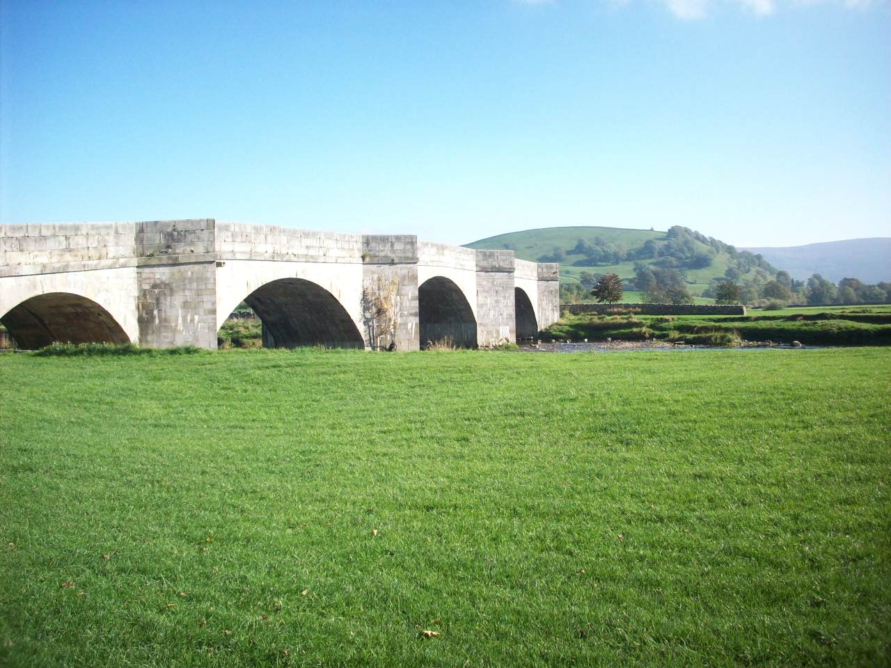
Burnsall Bridge. One of the most impressive contstruction of all Wharfedales road bridges and this scene is looking east towards Appletreewick Moor

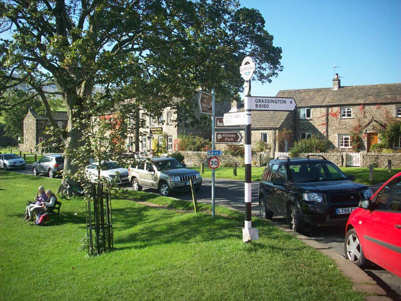
Burnsall. One of Wharfedales lovliest villages that is located at crossroads with The Way Of The Roses and Yorkshire Dales Cycleway.

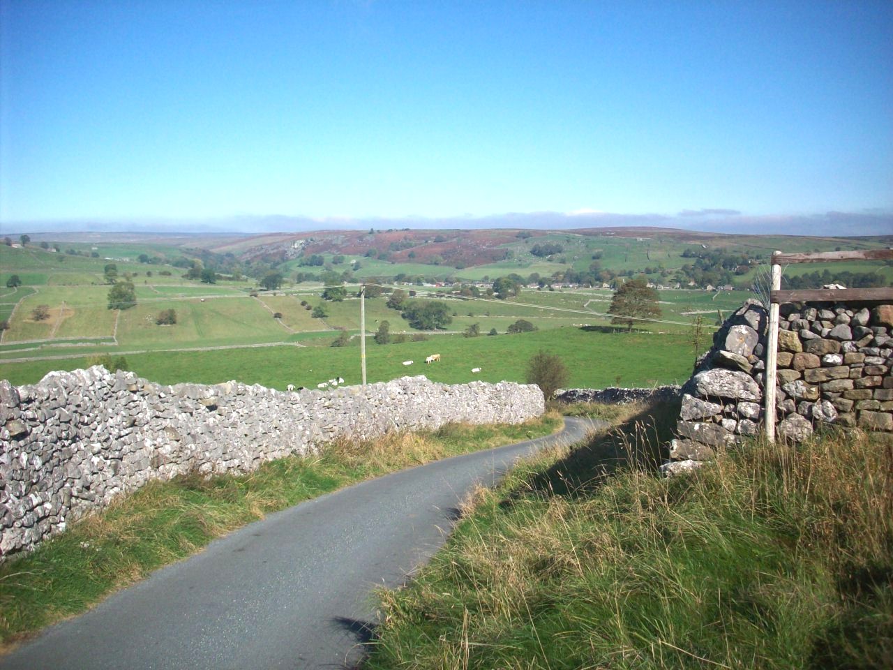
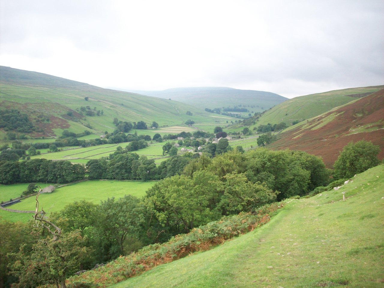
This scene is looking north east across Whafedale towards Hebden and taken on my approach to Thorpe and is located on The Way Of The Roses Route.

Grassington. The Capital town of upper Wharfedale located on The Yorkshire Dales Cycleway and hosts plenty of Pubs and Guest houses for all travelers

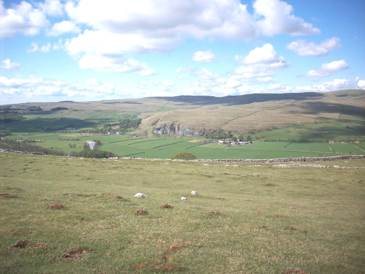
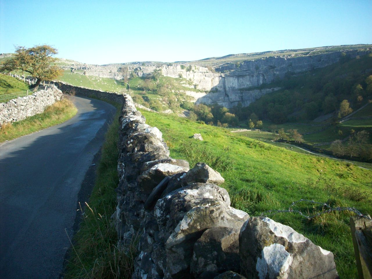
Kilnsey Crag. One of Wharfedales most picturesque limestone scenes and was taken on a cycle tour break of walking the Dalesway near Kettlewell.

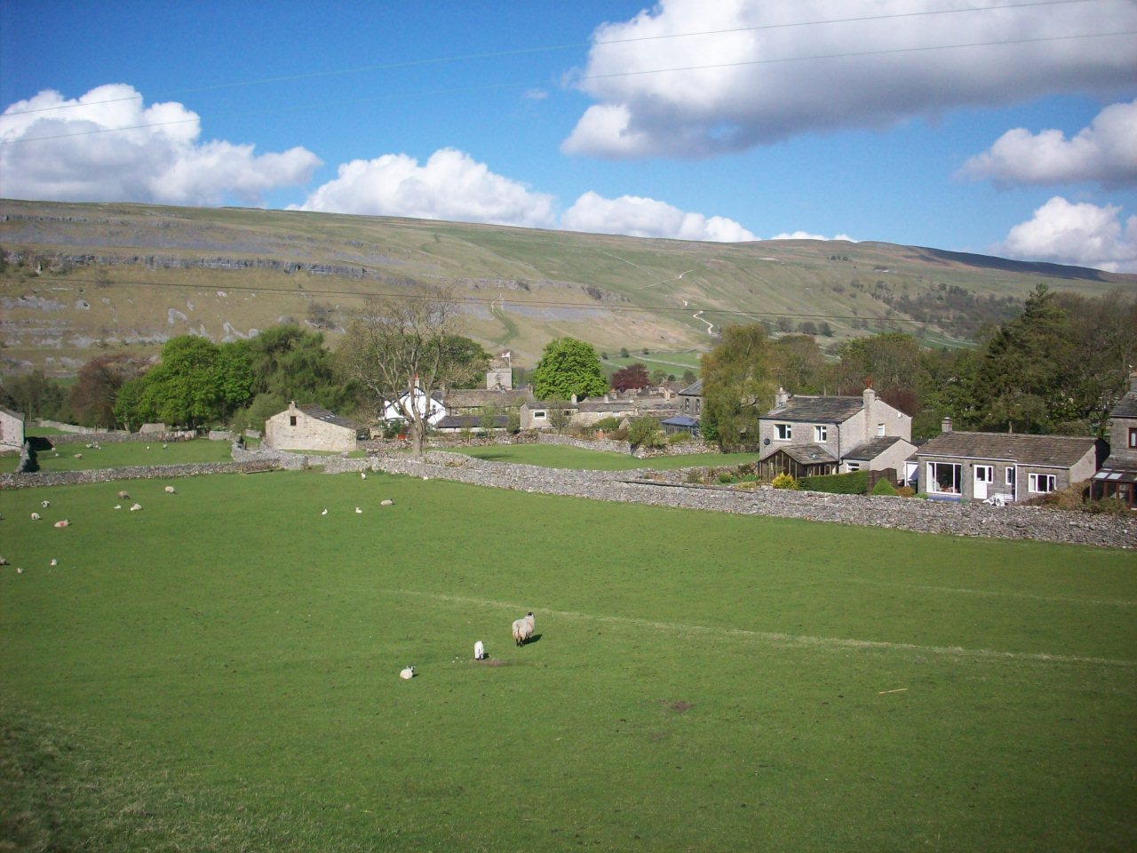
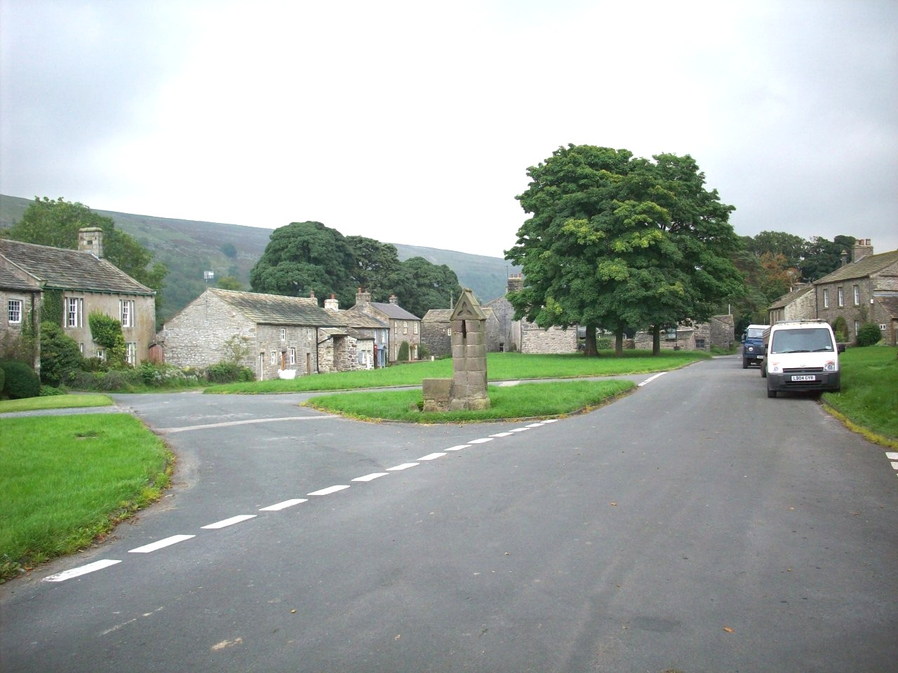
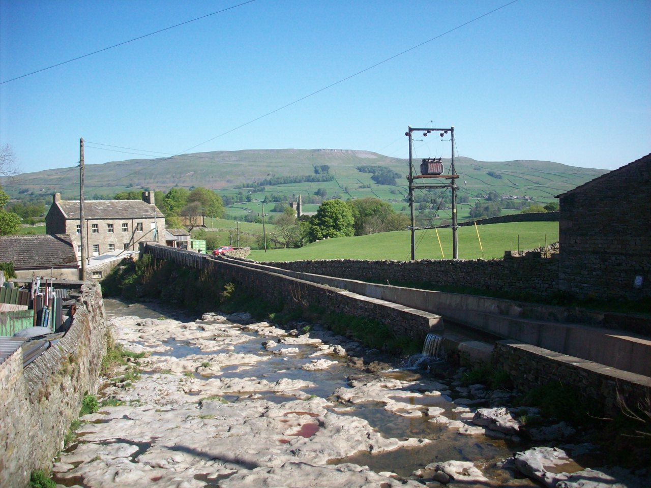
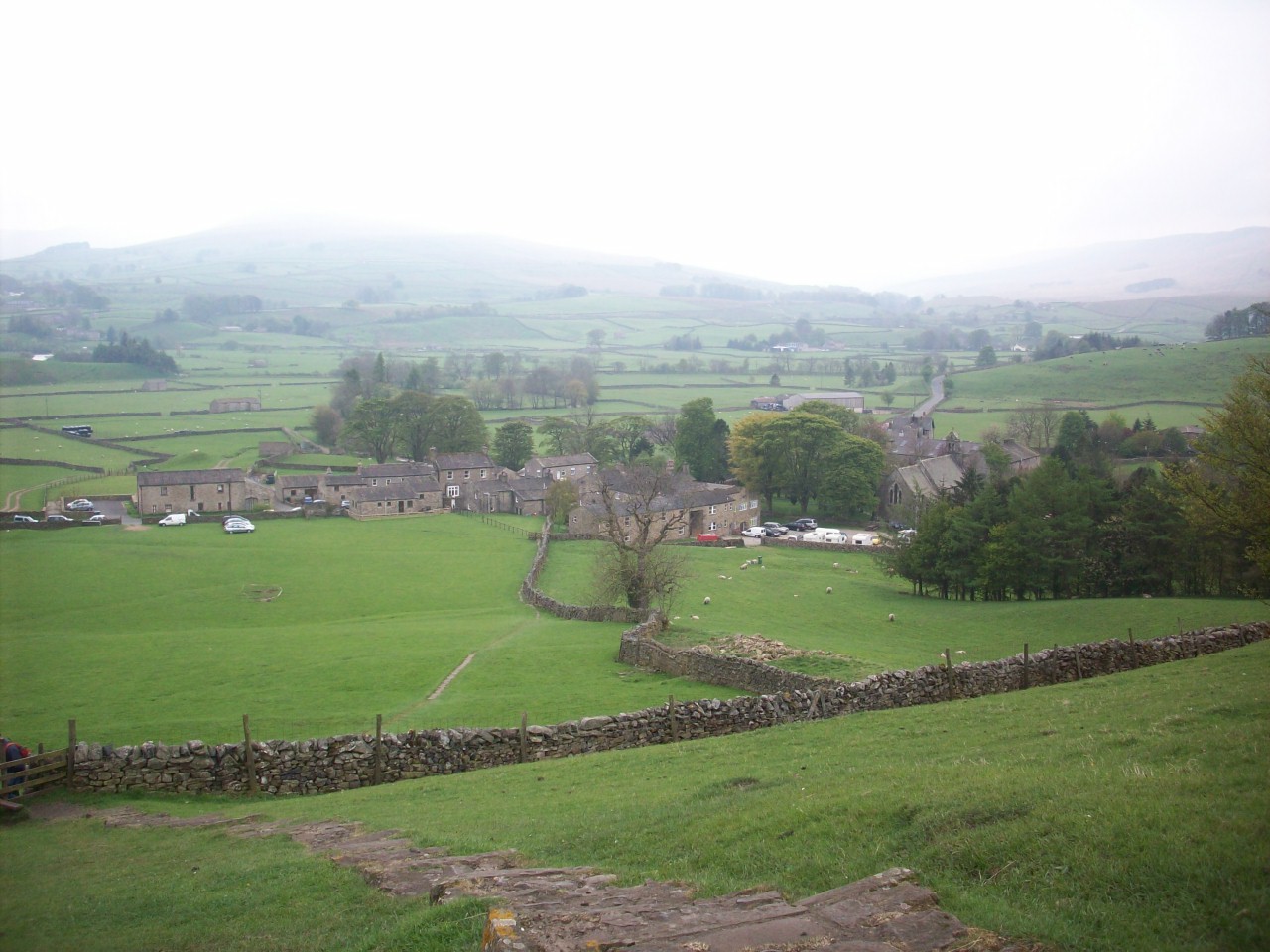
Kettlewell. One of Wharfedales most scenic and enjoyed villages with pleanty of hospitality for all cyclists and walkers.

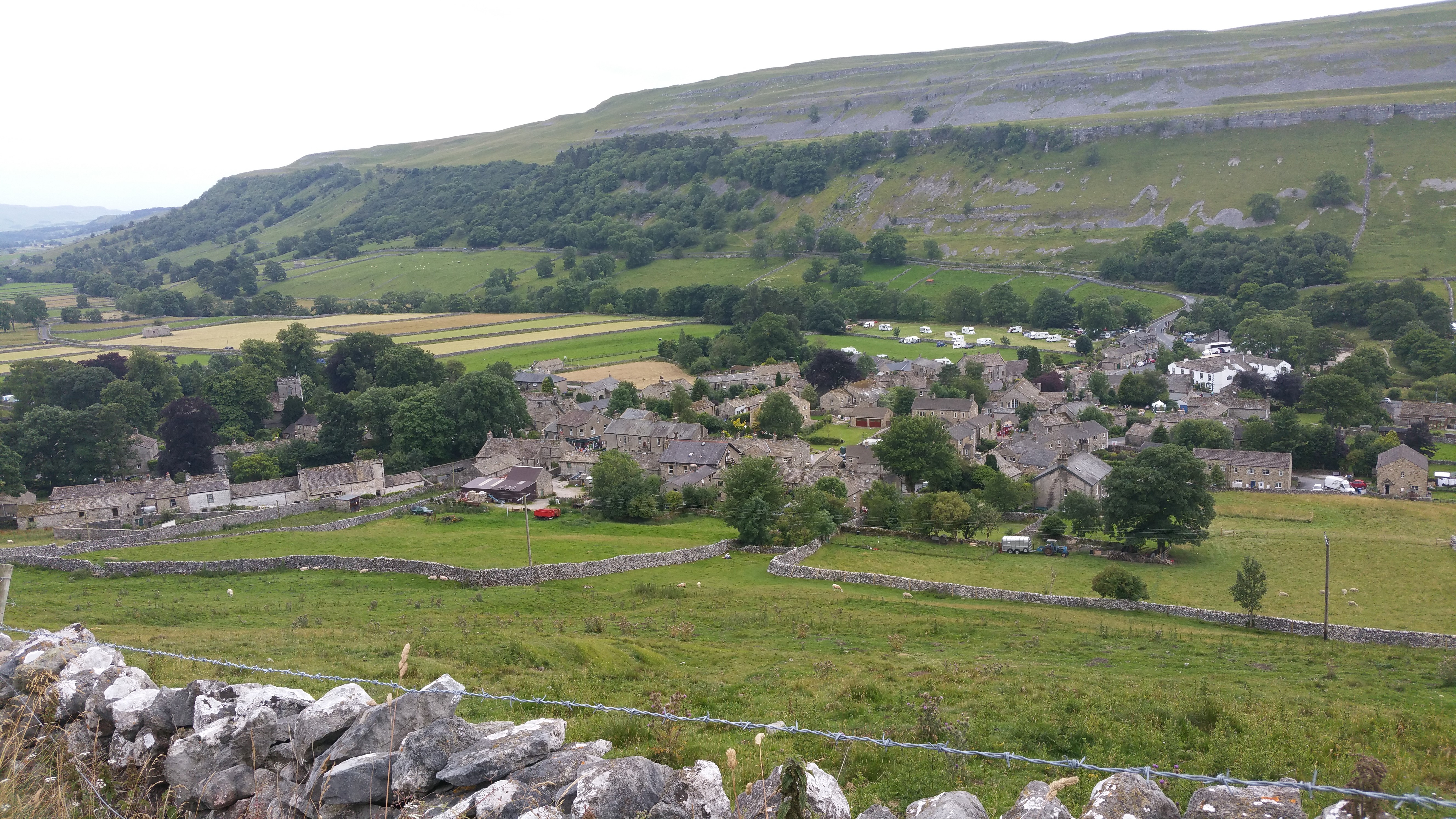
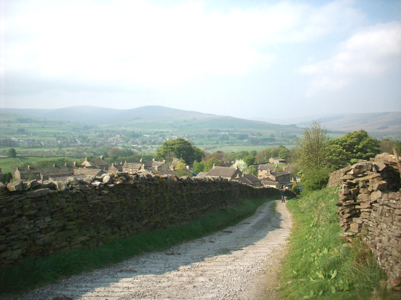
Kettlewell. This scene is looking west over the entire village and was taken on a walking break during a summer cycle tour of 2015.

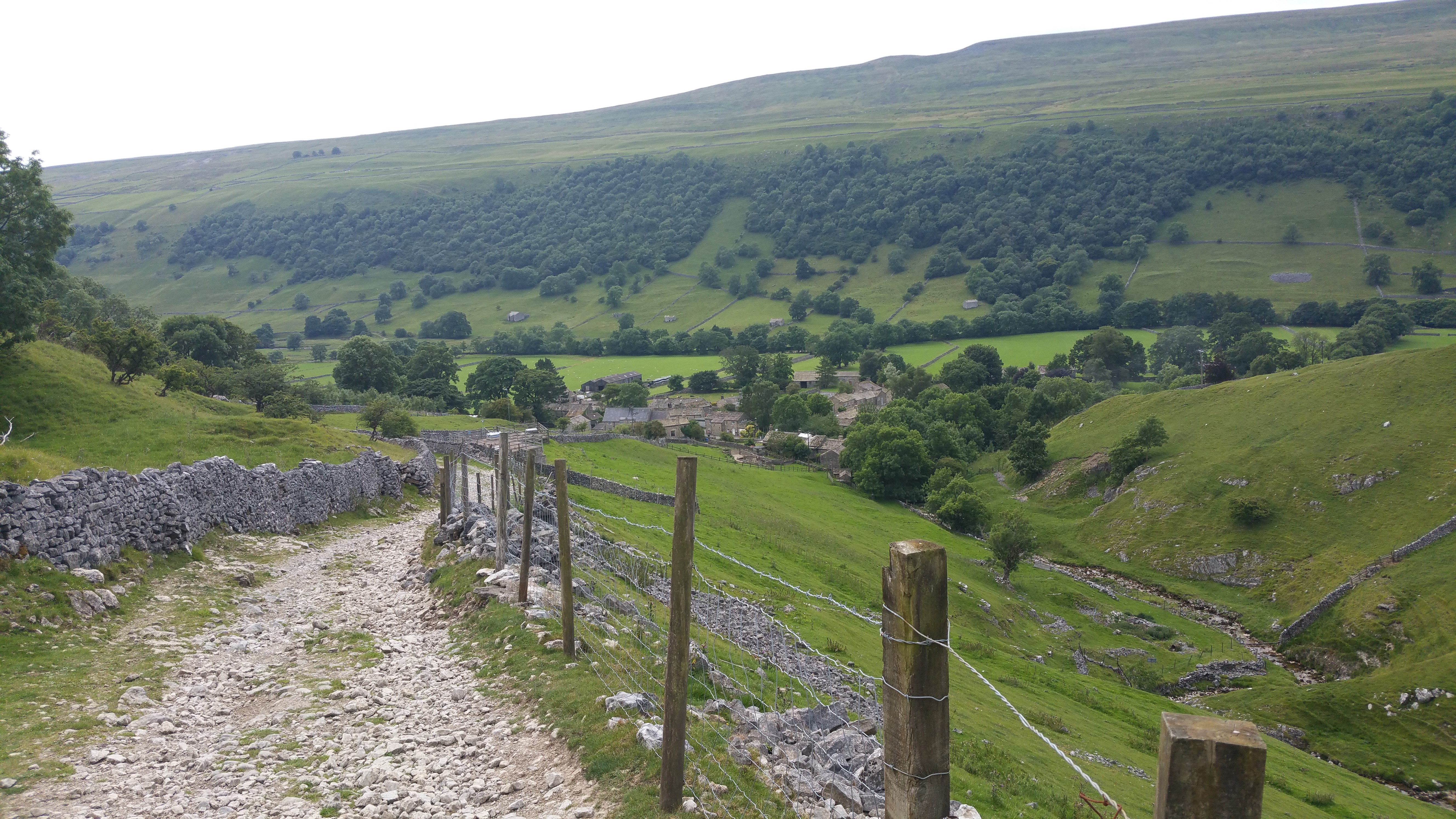
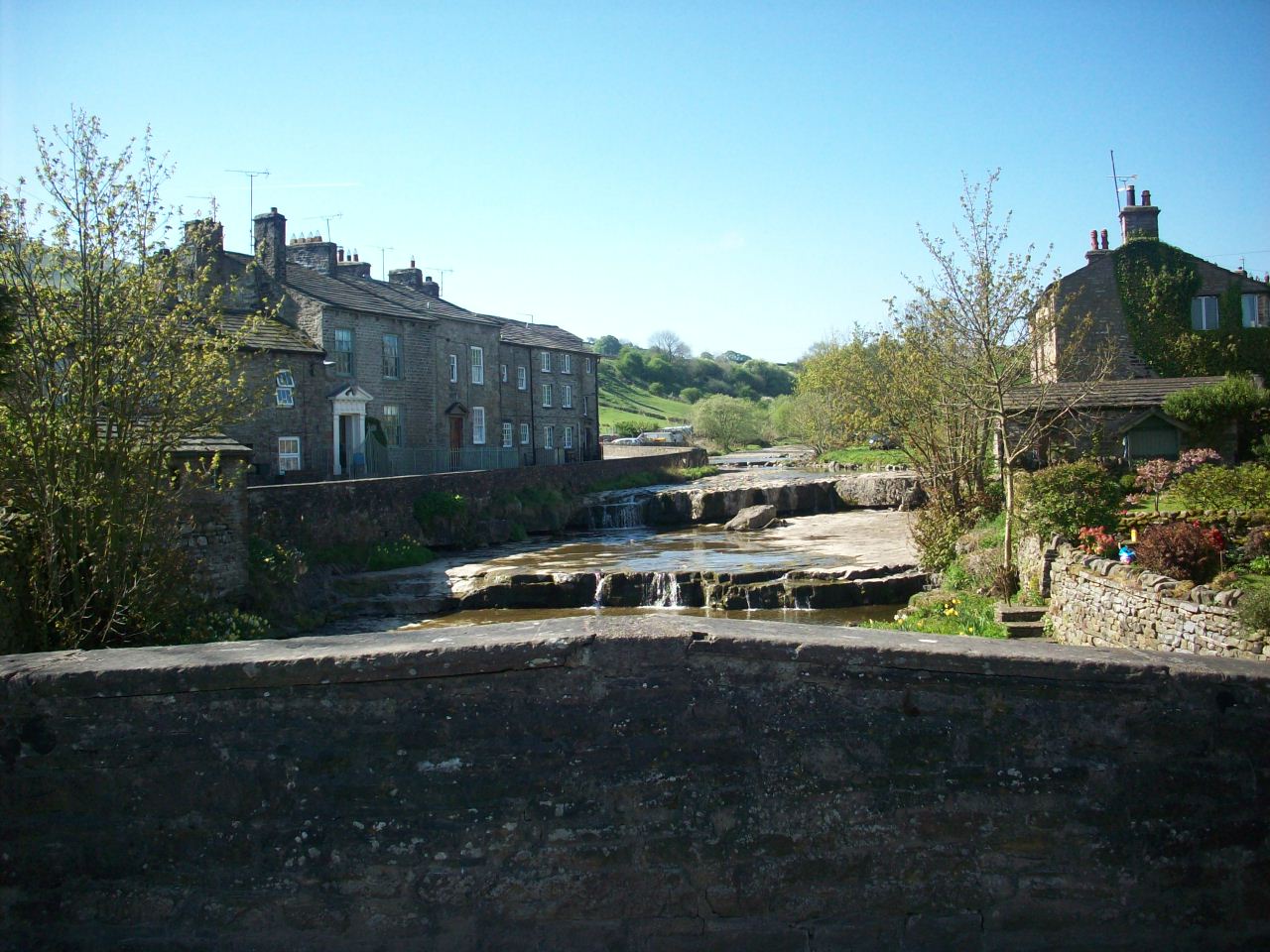
Kettlewell. Taken during a cycle tour break in summer 2015. This view is looking more east of the village with its grey stone cottages.

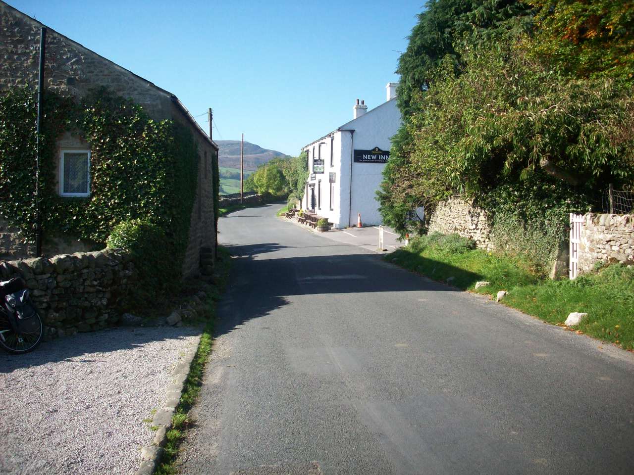
The George Inn. Situated in the village of Hubberholme where Upper Wharfedale now becomes Langstrothdale and is the link road to Hawes in Wensleydale

Hubberholme. This is looking over to the Church of St Michael and is the start of a long climb of one of England's highest roads into Wensleydale.

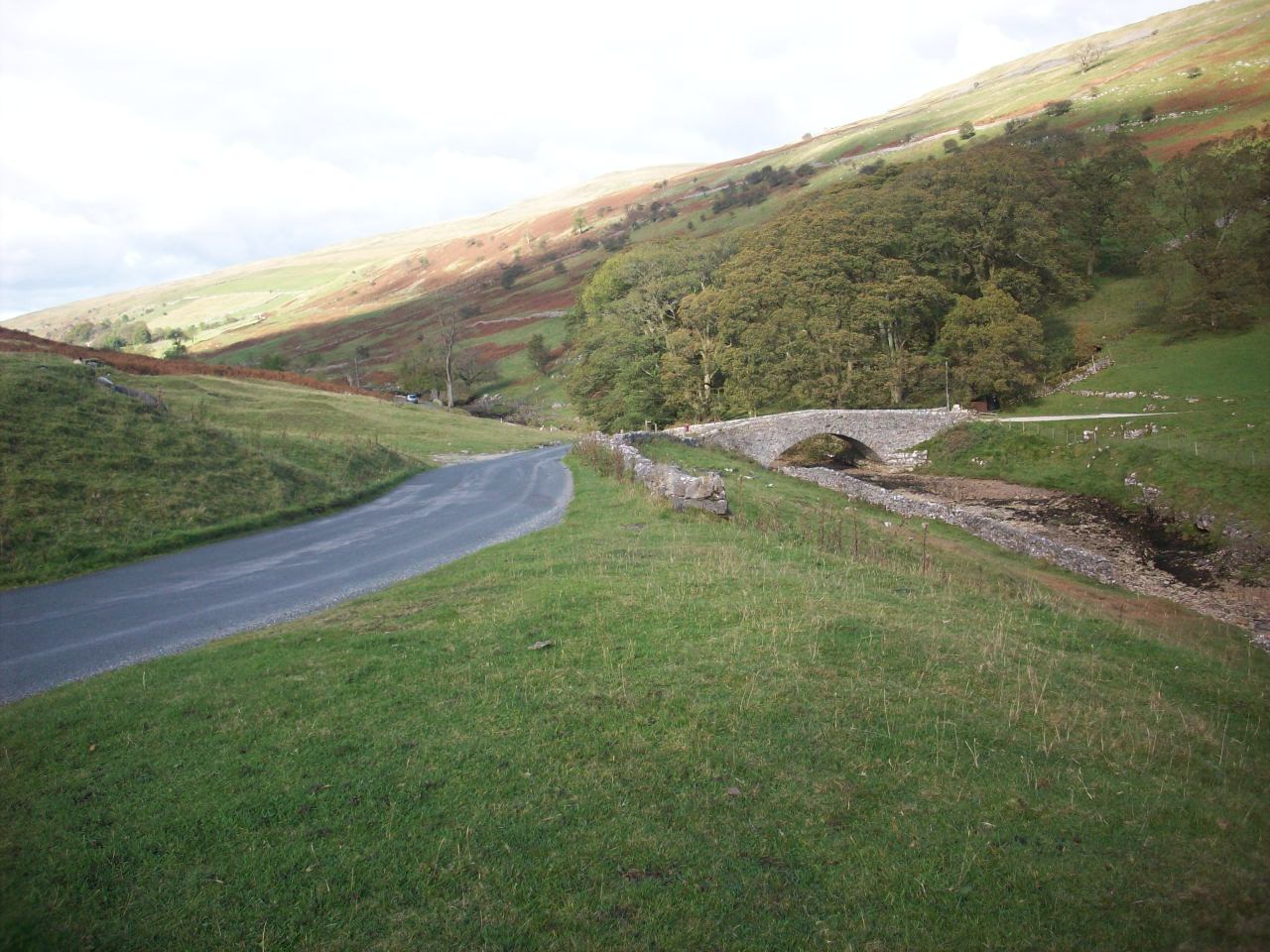
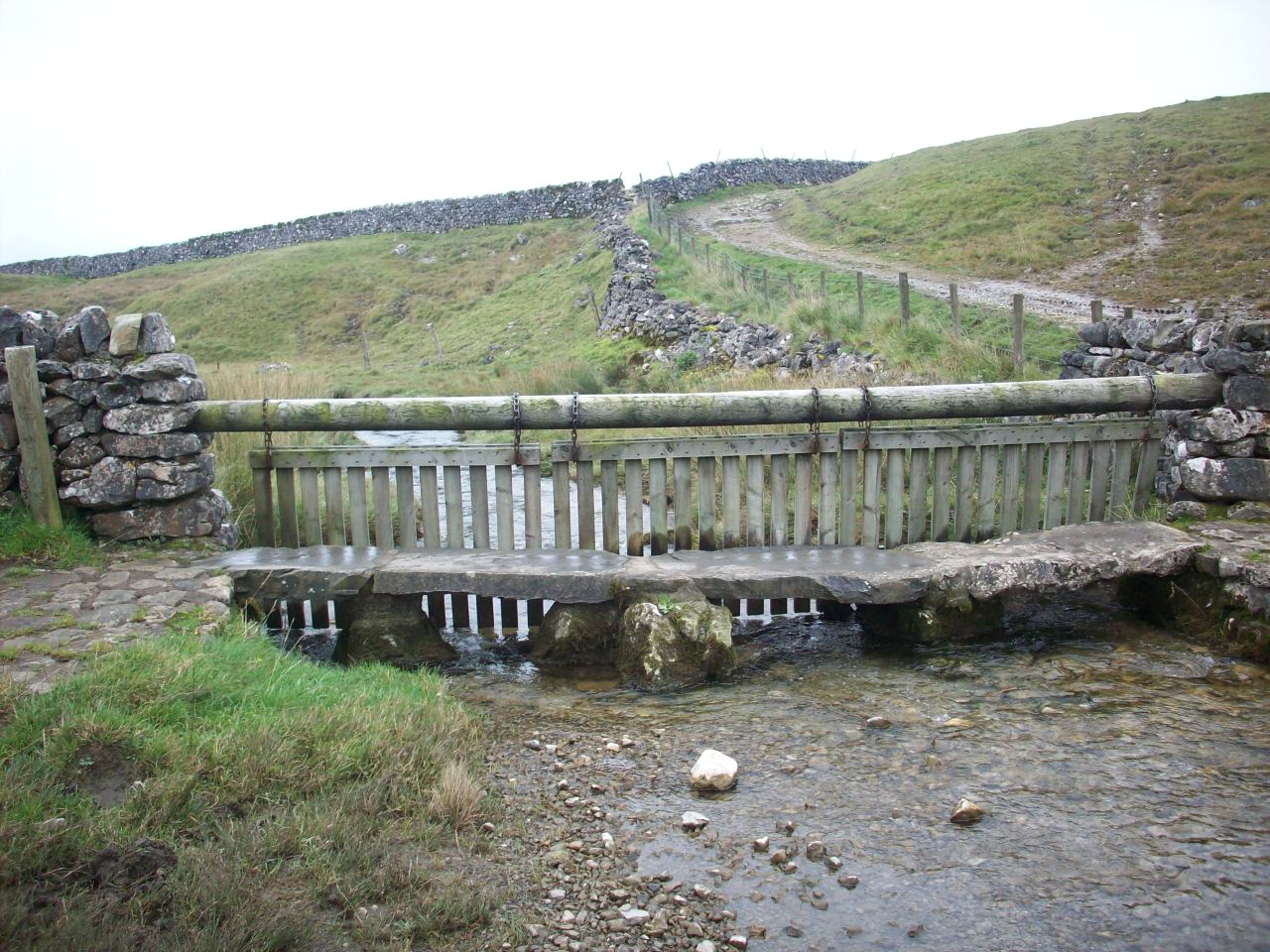
Yockenthwaite Bridge. Situated on the approach of one of Yorkshires highest roads that links Langstrothdale with Hawes in Upper Wensleydale

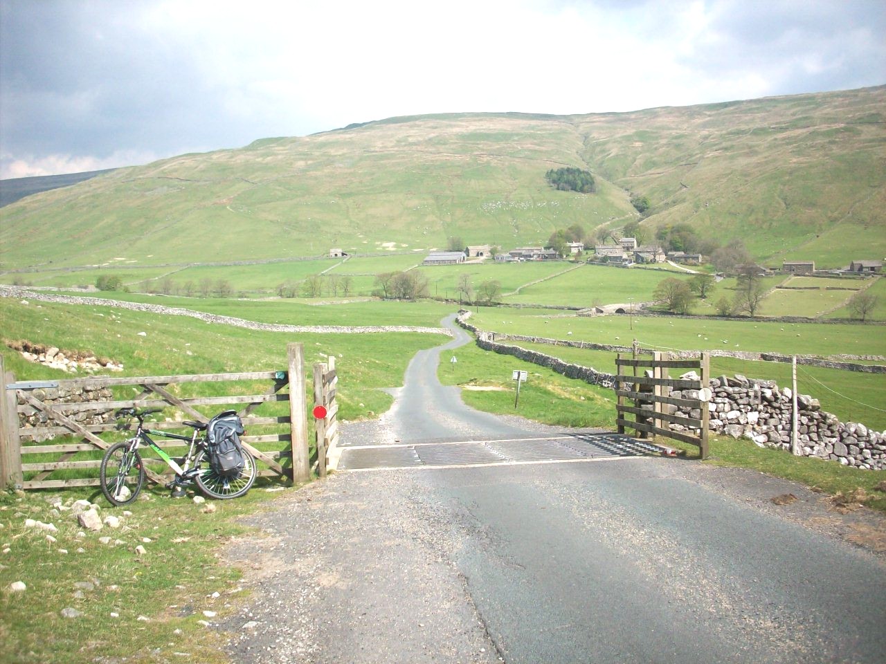
The Farm Hamlet of Yockenthwaite. Situated in Langstrothdale and this road can disappear in snow, being completely cut off during Winter seasons

Littondale. Really described as a Spur Dale from Wharfedale as the River Skirfare meets the Wharfe a mile north of Kilnsey Crag.

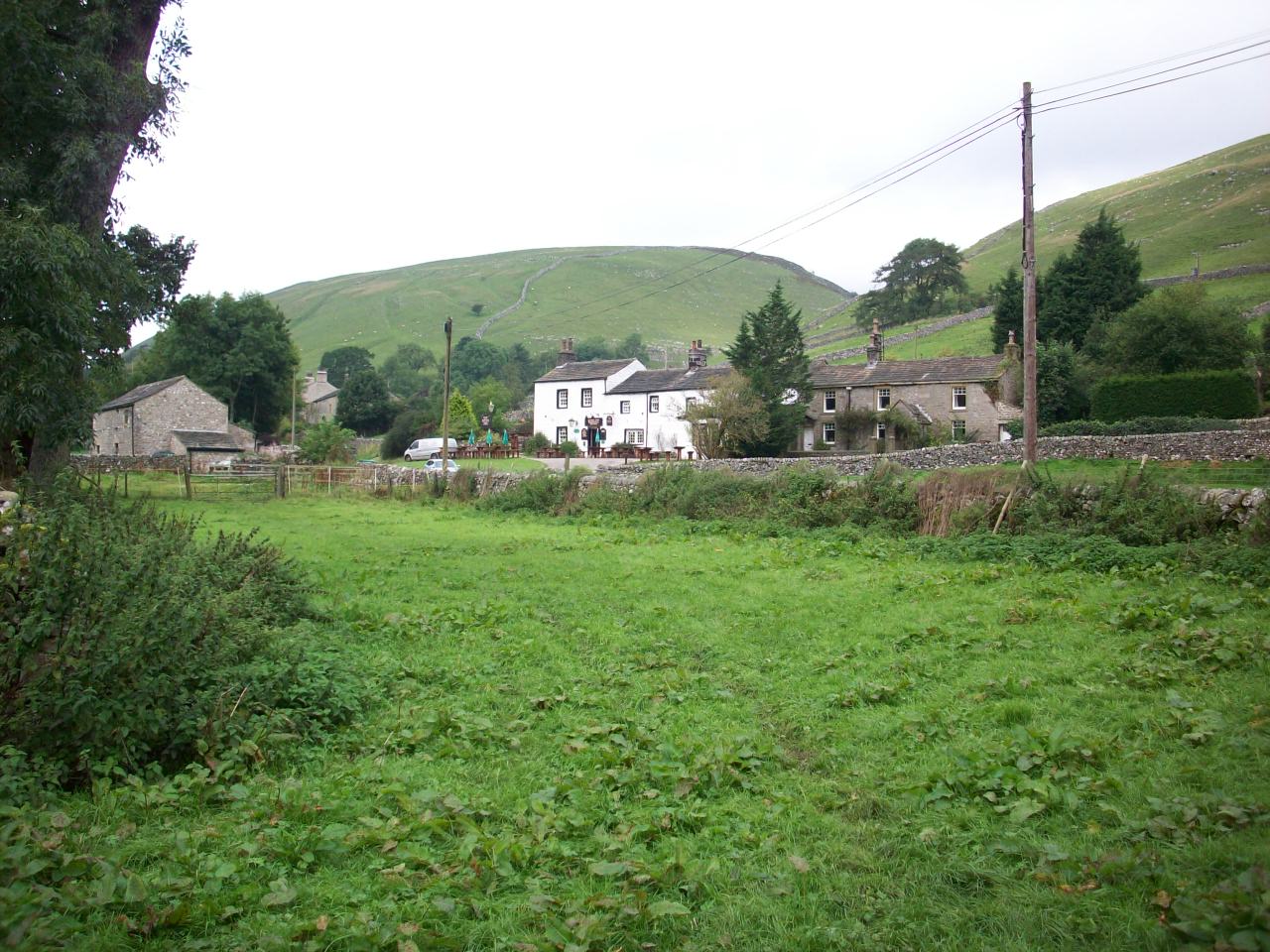
Litton. Situated on the Dalesway in Littondale and The white stone cottage in the middle is The Queens Arms, One of the Dales most friendly Pubs.

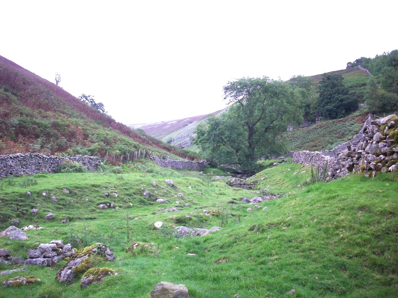
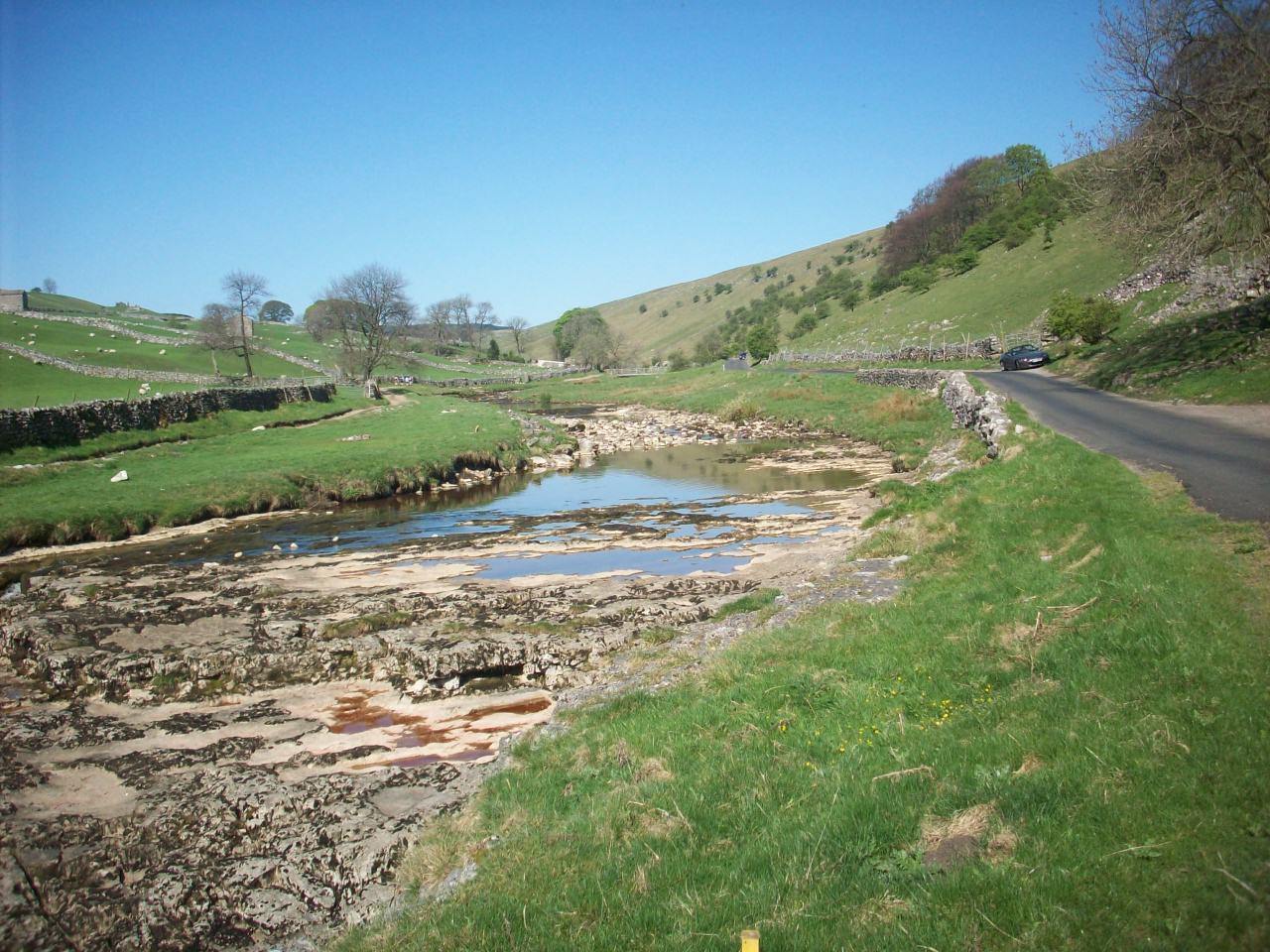
Crystal Beck. Situated about 1 mile north east of Litton village near The Dalesway and taken on a cycletour break of this area.

Arncliffe. Situated in the middle of Littondale and like Wensley it is noted for its tidy village green and handsome stone cottages.

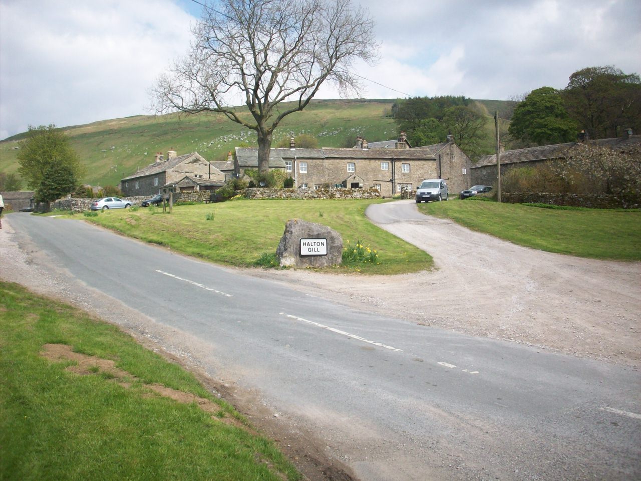
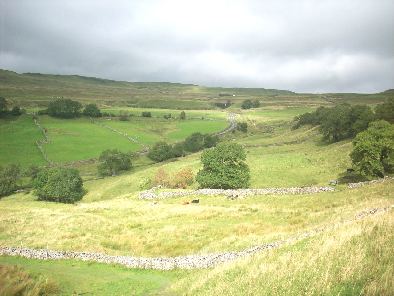
Halton Gill. A small little farming settlement situated at the northwest end of Littondale and was taken on my route to Settle.

This scene is looking down towards Halton Gill in Littondale and taken during my cycle tour of Ribblesdale and East Lancashire in May 2010.

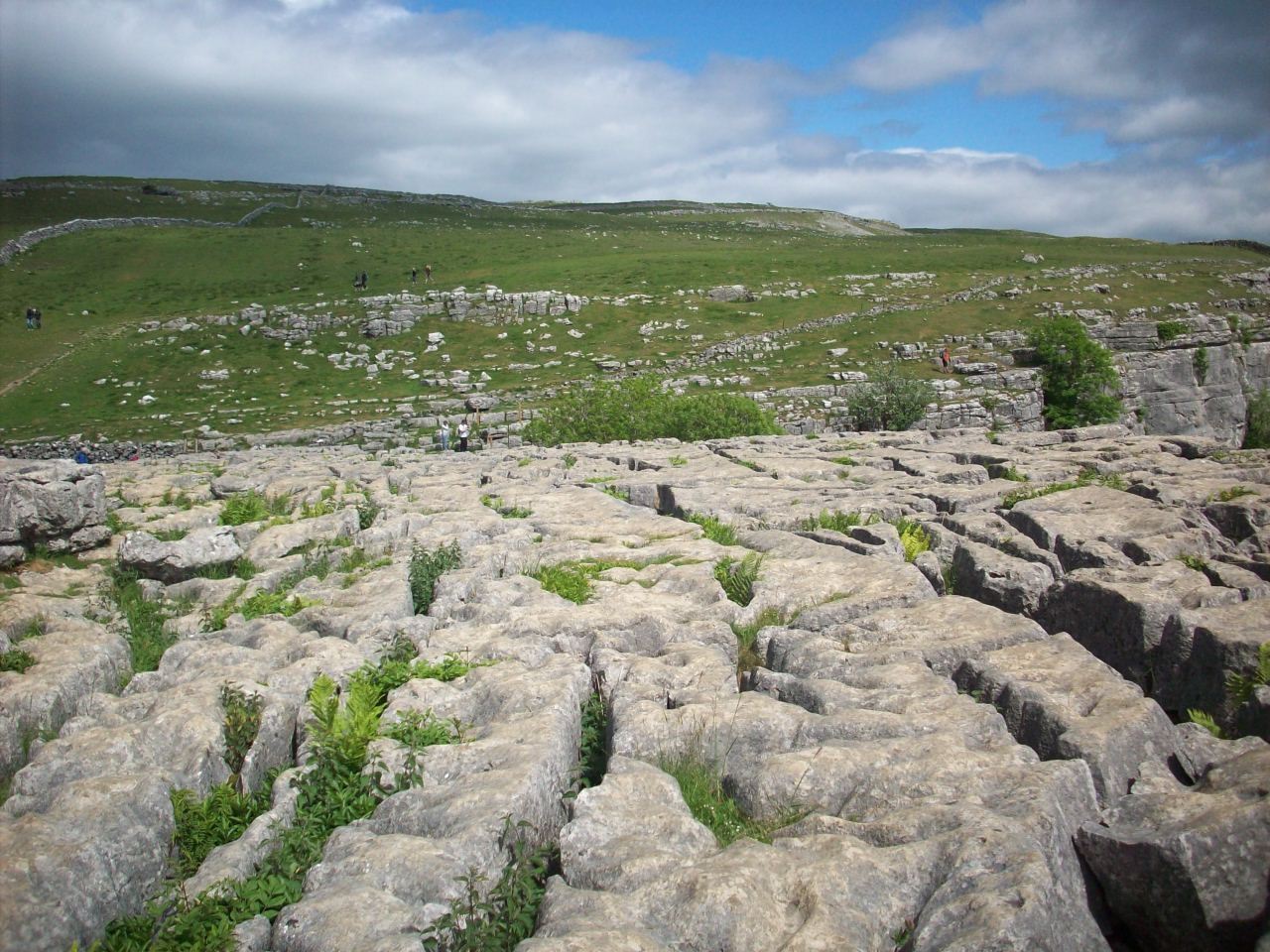
Landscape near Malham Cove. Known as Limestone Pavement and dates thousands of years back to the Ice Age. Taken while cycle touring this area.

Malham. Situated in Malhamdale on The Yorkshire Dales Cycle Way. Despite being a busy walking village it has a good Youth Hostal and 2 Pubs.

The uphill stretch of The Yorkshire Dales Cycleway. This scene is the approach towards Malham Cove as you climb out of Malham village.

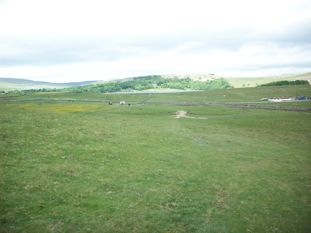
Malham Tarn. Known as Yorkshires mini lake district and is where the infant River Aire starts its long journey to meet the Ouse near Goole..

Another scene of Malham Tarn Lake and is situated on the Yorkshire Dales Cycleway of route 10 and Joins The Pennine cycleway at Settle.

Another taste of off road cycling. This is the Malham Tarn to Kilnsey bridleway and this location is at Goredale Beck on my approach to Wharfedale.

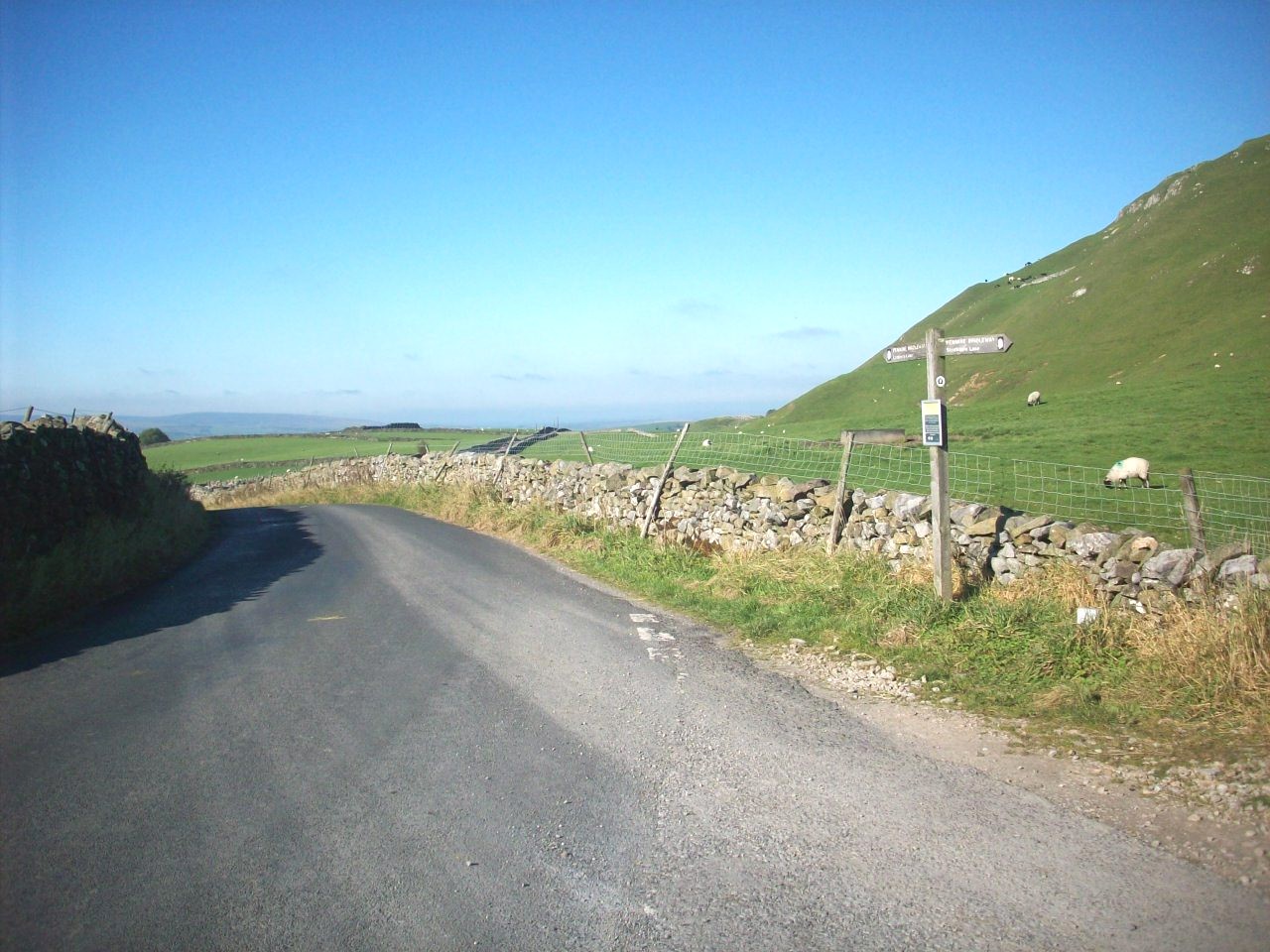
This scene is the Malhamdale to Ribblesdale section of The Way Of The Roses Cycle route, located at a junction with The Pennine Bridleway near Settle.

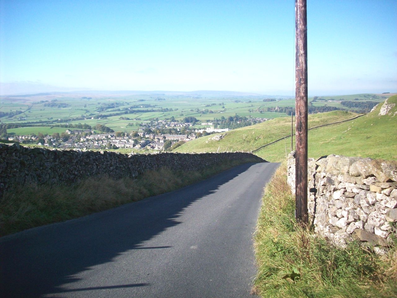
This scene is looking down into Settle, on the Way Of The Roses route with clear westerly views of The Bowland Hills.

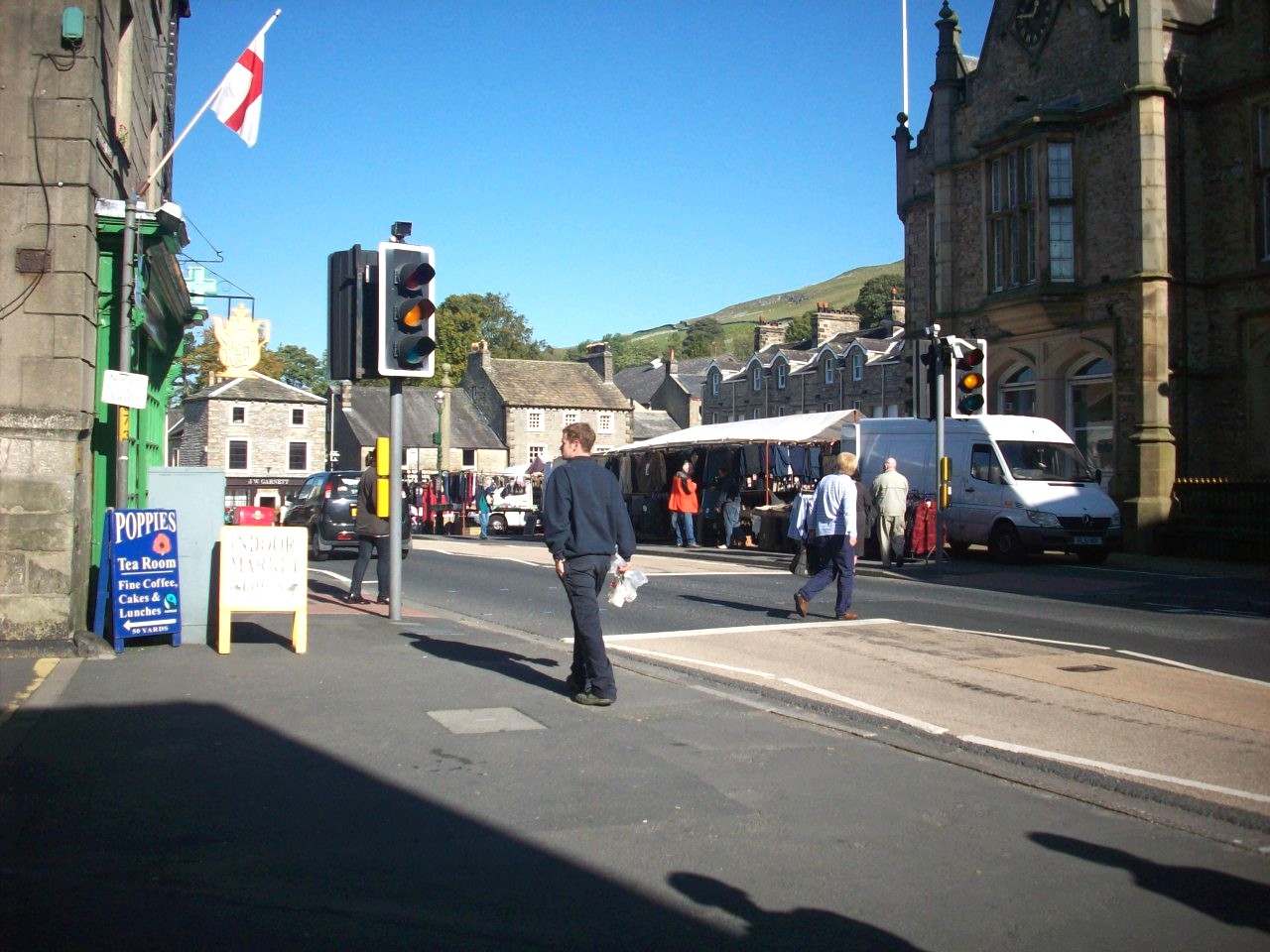
The busy market town of Settle and is the Capital town of Ribblesdale. This is a Tuesday market scene.

My onroad route of this entire cycle tour to this part of the Yorkshire Dales from my home town of Harrogate.

This Scene is looking towards Cray Gill situated on the Buckden to Wensleydale link road and is one of the infant becks that feed the River Wharfe.

This scene is on the Buckdon to Hawes Road through Langstrothdale and was taken during my 2011 cycle tour up to Wensleydale.

Gayle. Situated in upper Wensleydale and its first sight gives you that well earned feeling after the long climb over Langstrothdale Chase.

Gayle. Another scene of this lovely Wensleydale Vilage and situated about 1 mile southwest of the Market Town of Hawes.

Wensleydale. This scene is looking into the lovely hillside village of Sedbusk with magnificant views of the western end of the dale.

This scene is looking down into the Wensleydale village of Hardraw and is home to Englands highest force water falls.

Please left click on selected picture to enlarge image


Links To My Other Cycle Touring Pages Related To The Yorkshire Dales

Home Page

Pictures From My Cycle Tour Of The Eastern Dales Featuring Highlights Of The Beryl Burton Cycle Route

Pictures From My Cycle Tour Of Swaledale And The North Pennines

Pictures From My Cycle Trail Of The Nidderdale Greenway


Links To My UK Cycle Touring Pages From https://www.philsonlinephotosite.co.uk

Photographs From My Cycle Tours During The 1980s

Pictures From My Cycle Tour Of East Yorkshire Featuring The Trans Pennine Trail

Pictures From My Cycle Tours Of The North York Moors And East Coast

Pictures From My Cycle Tour To North Wales From Harrogate Via The Trans Pennine Trail

Pictures From My Cycle Tour Of Scotland

Pictures From My Cycle Tour Of Lancashire Featuring Morecambe Bay And The Forest Of Bowland

Pictures From My Cycle Tour Of Cumbria Featuring The North Pennines And Lake District 

Pictures From My Cycle Tours Of South East England


Links To My Cycling Videos Related To The Dales

Full Footage Of My 2016 Great Yorkshire Cycle Tour - YouTube Includes footage of Coverdale and Wharfedale Villages.

My 2016 Cycle Tour Footage Of The Yorkshire Dales - YouTube Includes footage of Dentdale and Upper Wensleydale.

My Wharfedale To Malhamdale Cycle Trail - YouTube Includes footage of Littondale and Malhamdale including some of my walks around Malham Cove and Goredale Scar.


Site Navigation Map Of All My Web Links

mailto:philip@philsvalveradiosite.co.uk