Pictures From My Cycle Tour Of Swaledale And The North Pennines

Welcome to this part of my site featuring some exciting pictures from my cycle tour of Swaledale and The North Pennines. Pictures in the order of 1 to 18 feature Swaledale and Arkengarthdale and is the most northerly part of the Yorkshire Dales. Due to the lack of busy A roads through this Dale it draws less visitors then nearby Wensleydale and providing you don't pick a busy bank holiday weekend or scorching hot summer holiday week, cycling can still be a great pleasure for exploring this Dale. The B6270 between Reeth and Kirkby Stephen is one of the most narrow sections of roads in the country to be designated as a second class road and as a result this is why this Dale is very quiet compared to its neighbours. Swaledale is also the most beautiful parts of The Yorkshire Dales ranging from its steep wooded hillsides in the mid section of the Dale to the rugged green hillside country in the upper section around Thwaite and Keld featured in pictures 11 to 18. Centuries ago Lead Mining used to be the order of the day in this part of the Dales and its main industries nowadays is Sheep Farming which makes the Dale famous for its Swaledale Wool and tourism that keep this Dale moving. In winter this Dale has been known to be completely cut off with most moorland roads disappearing in snow and as public transport is very scarce through the Dale, life can be difficult for elderly people that don't have any other modes of transport. Pictures 6 and 7 feature Reeth, the largest village in Swaledale noted for its lovely village green and the last real place of civilisation for 20 miles, so I would make sure you are well kitted up food wise if venturing in the westerly direction of this Dale. Arkengarthdale featured in pictures 8 and 9 is the most isolated and northerly part of The Yorkshire Dales and also forms part of the national cycle network route 71 to the Lake District. The isolated village of Langthwaite featured in picture 9 is famous for filming of The James Herriot TV series, All Creatures Great And Small and The Red Lion Inn was one of the locations. Picture 10 features The Tan Hill Inn, England's highest public house and stands at the foot of Arkengarthdale in one of the most remote and barren stretches of The North Pennines. The Pennine Way from Keld also passes by this pub. Although there used to be coal mining in this area centuries ago, the mines have long gone and the pubs open coal fire still burns 365 Days a year. Pictures in the order of 19 to 30 feature my visit to East Cumbria and as this website is really supposed to be a site relating to The Yorkshire Dales, why have I included Cumbria you may ask? The gap between the Yorkshire Dales and the Lake district is only about in some cases 15 to 20 miles and lies in some of the nicest and most scenic cycling country in northern England with its nearby towns and villages having the same characteristics of the Dales. Picture 19 is looking back towards the Eden valley near the market town of Kirkby Stephen featured in picture 20 and was taken while venturing back on the B6270 into Swaledale. Kirkby Stephen is a lovely market town, served with plenty of cafes and pubs. It also lies on the Cumbria Cycle Way and The Coast To Coast Walk. Kirkby Stephen is also well served with a Youth Hostel and a Railway station located east of the town on the famous Settle to Carlisle Railway. Pictures 21 and 22 feature the North Pennine town of Appleby In Westmorland, also located on the Settle to Carlisle Railway and Like Kirkby Stephen it is well served with teashops and pubs. Appleby In Westmorland is famous for the largest gypsy gathering in the country as it hosts its Horse Fair every year during June. Pictures 23 to 30 feature some of the most outstanding Pennine scenery in Cumbria with many quite roads and makes it ideal cycling country. The village of Dufton featured in the pictures of 23 and 24 is located on the Pennine cycleway of route 68 and is also served with a Youth Hostel and Pub. At the time of writing this page on 12.10.08, the shop in Dufton village has reopen but no longer has a Post Office. Pictures in the order of 25 to 30 feature my day walk of the Pennine Way north of Dufton towards Langdon Beck, in Teesdale.  More on Cumbria can also be found on my following new link Pictures From My Cycle Tour Of Cumbria Featuring The North Pennines And Lake District                                 

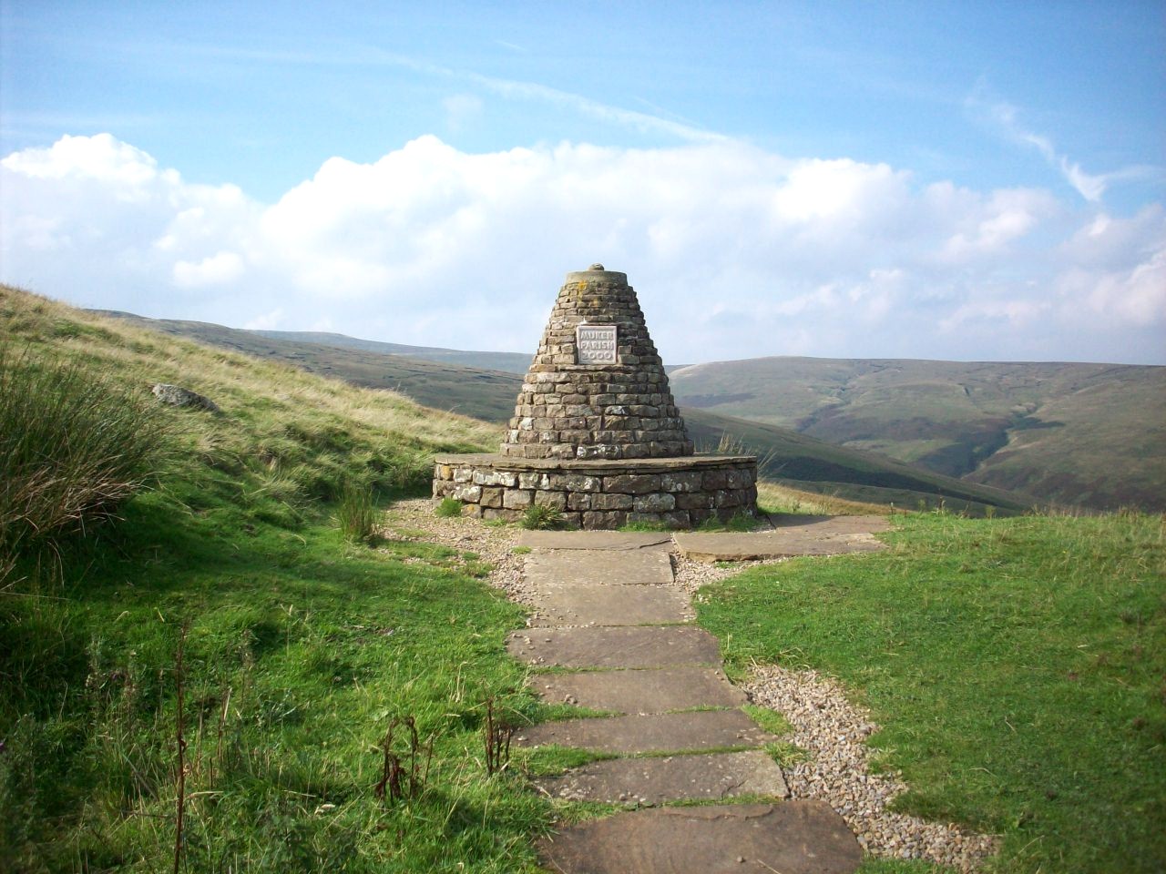
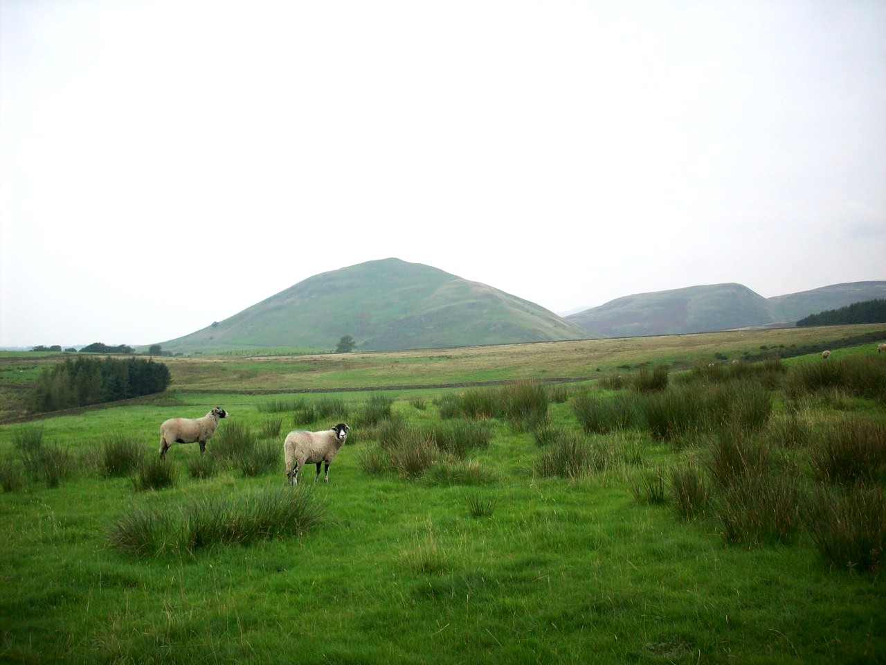
Askrigg Common. This scene is looking down into Wensleydale towards Askrigg village. Taken on my departure into Swaledale.

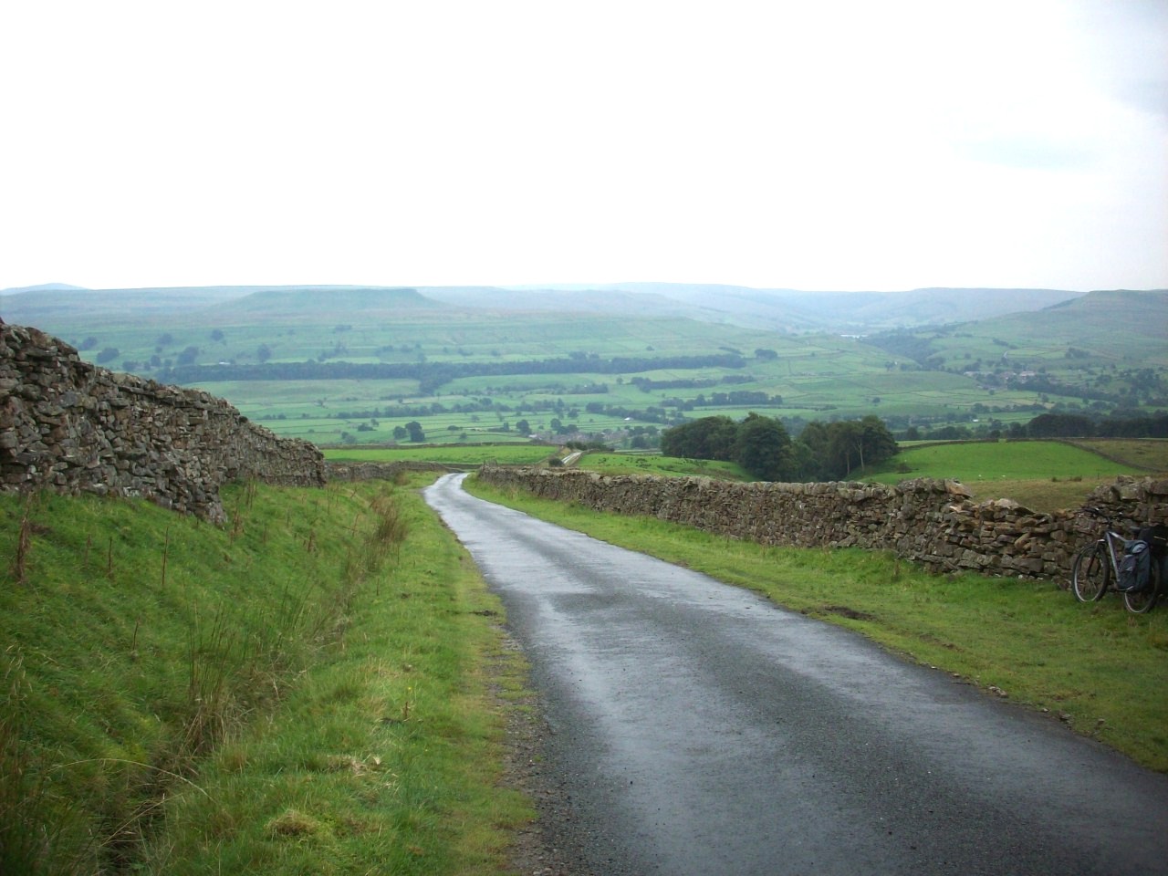
First view of Swaledale. This is near Summer Lodge Moor, Looking over towards Crackpot Side and was taken on my the second day of this tour.

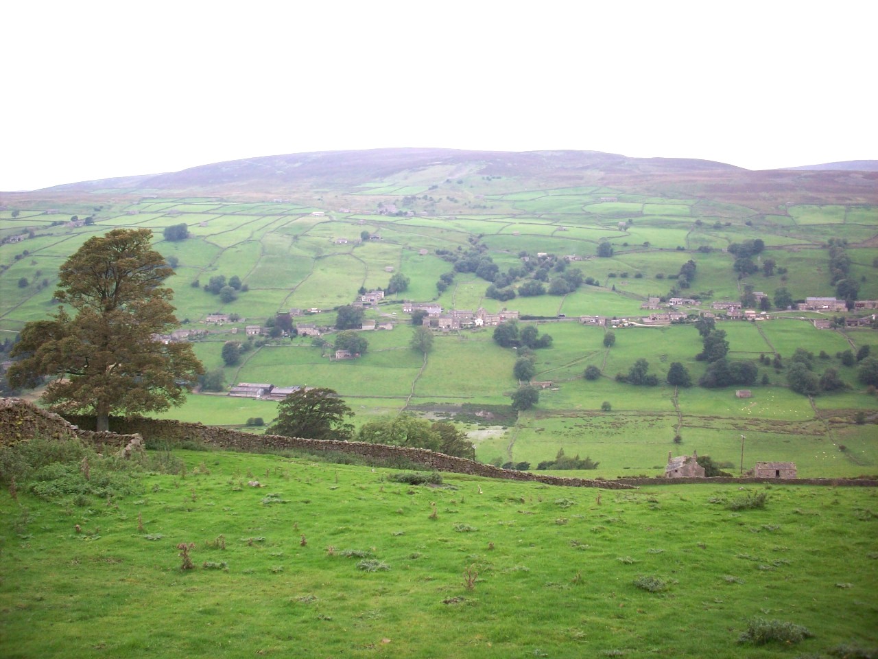
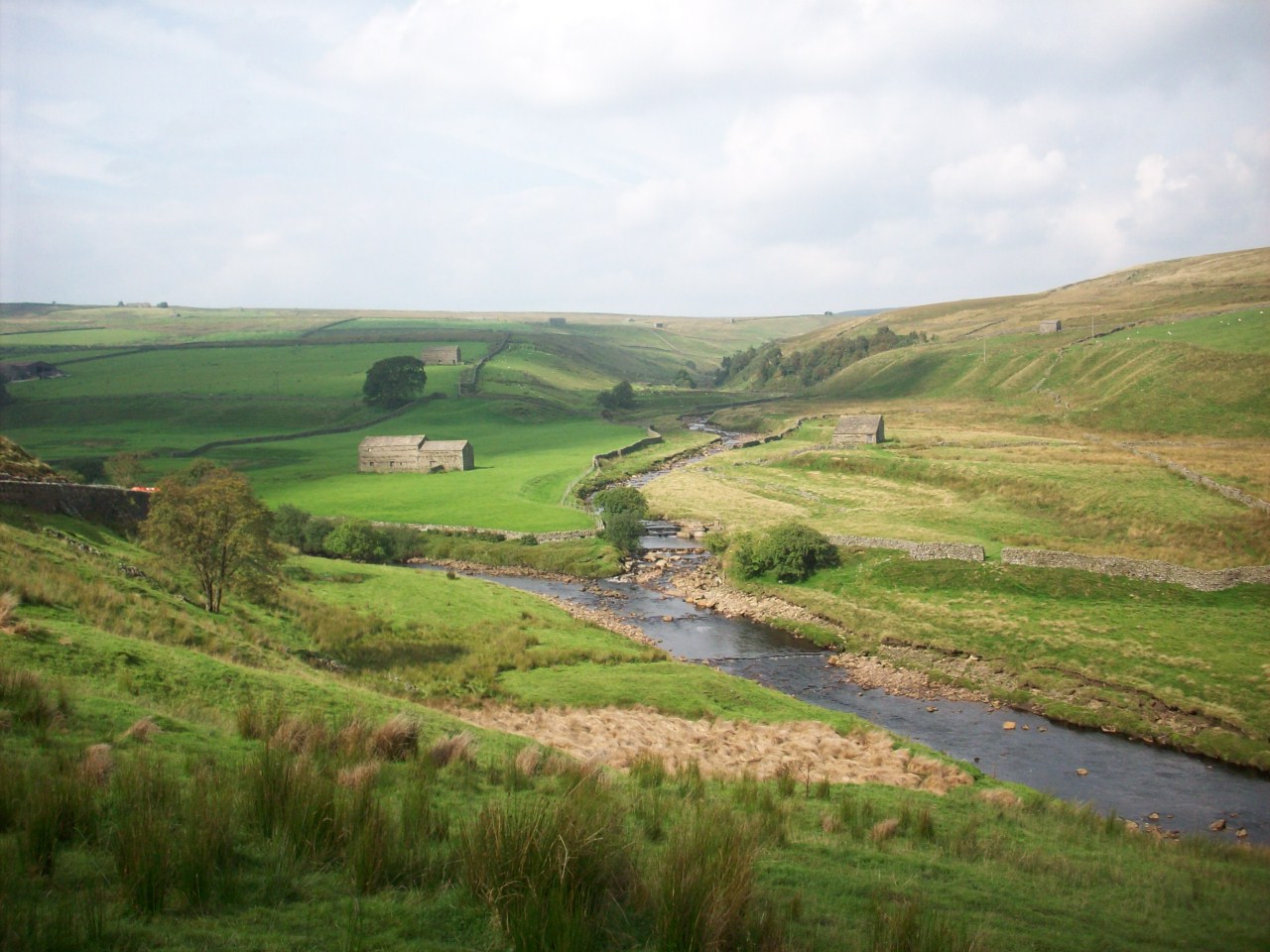
Swaledale. This is looking across towards the villages of Low Row and Feetham from the south side of the Dale.

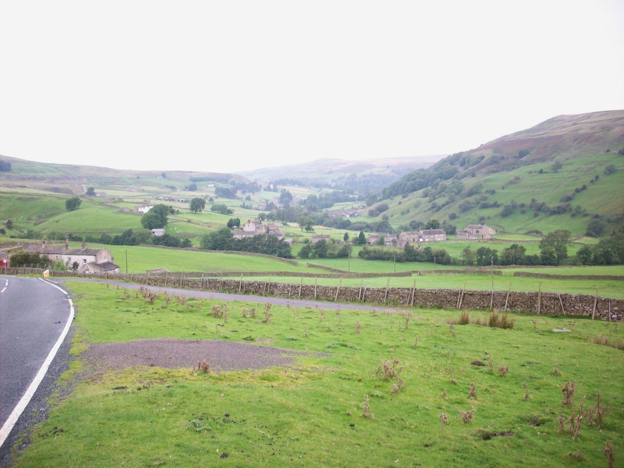
Swaledale. This is looking over towards Reeth Low Moor and was taken on the last decend into this Dale on the second day of this tour.

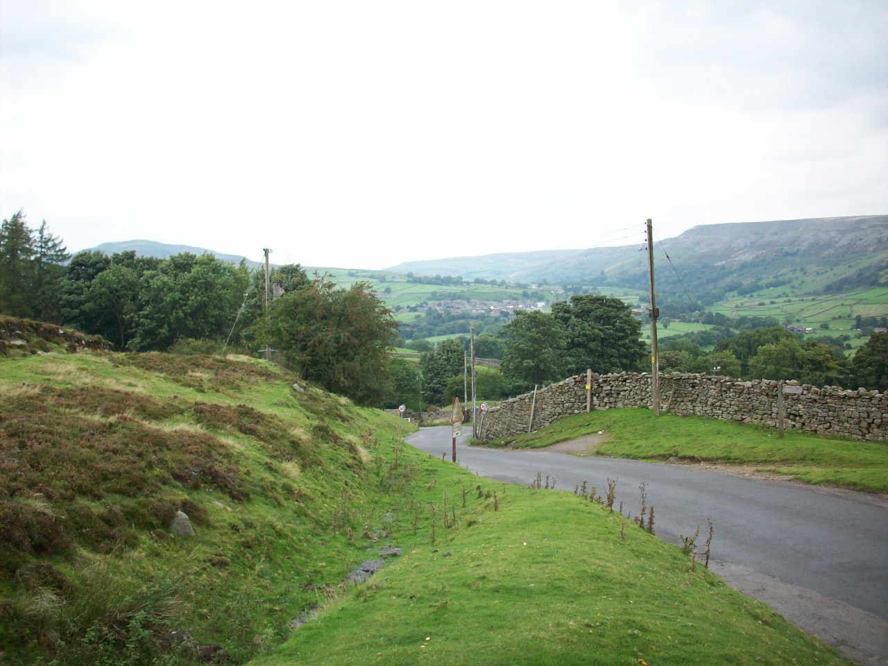
Grinton Moor. This scene is on the Layburn to Grinton Road not far from Grinton Lodge Youth Hostal where I had my second night stay in the Dales.

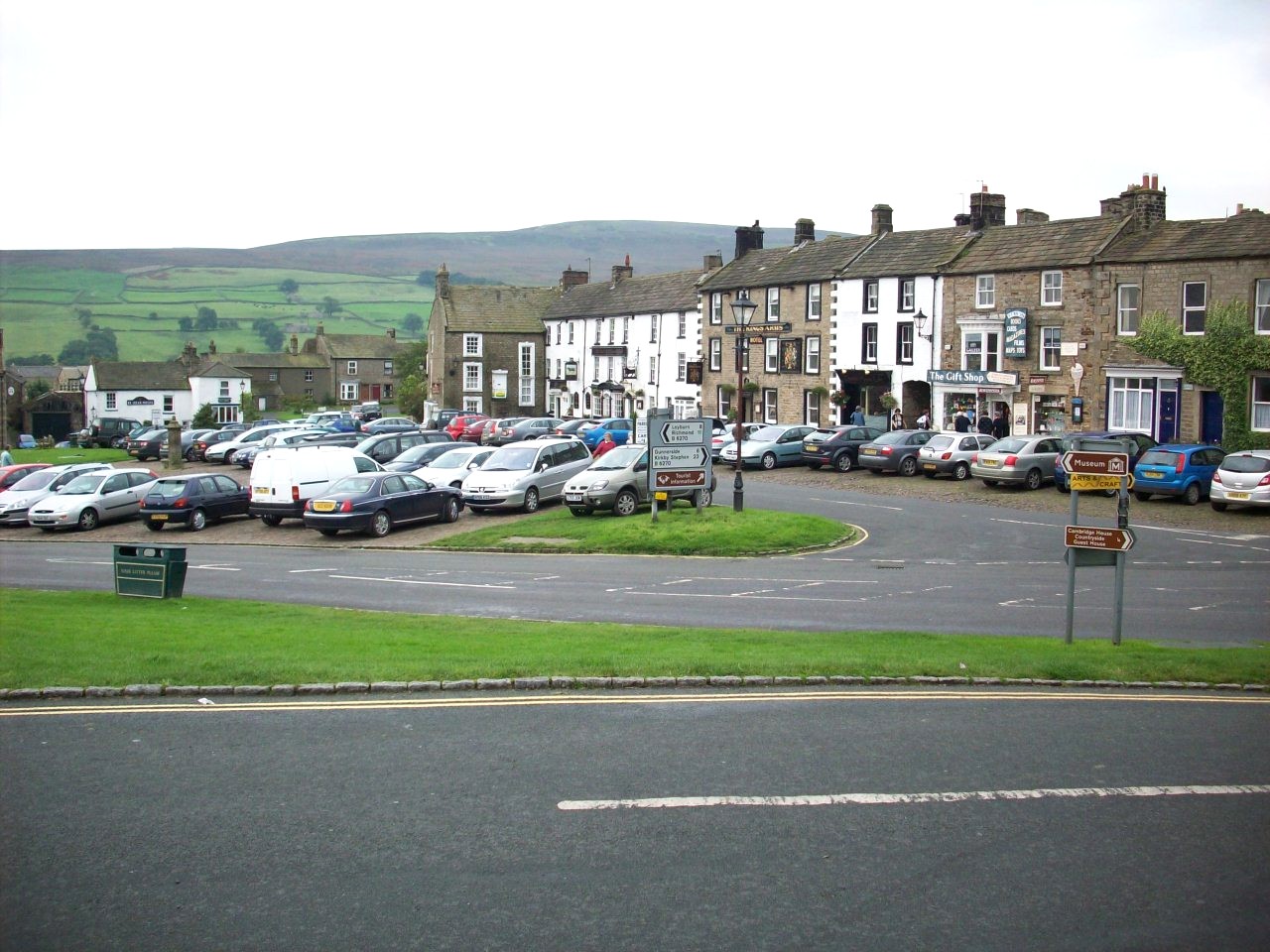
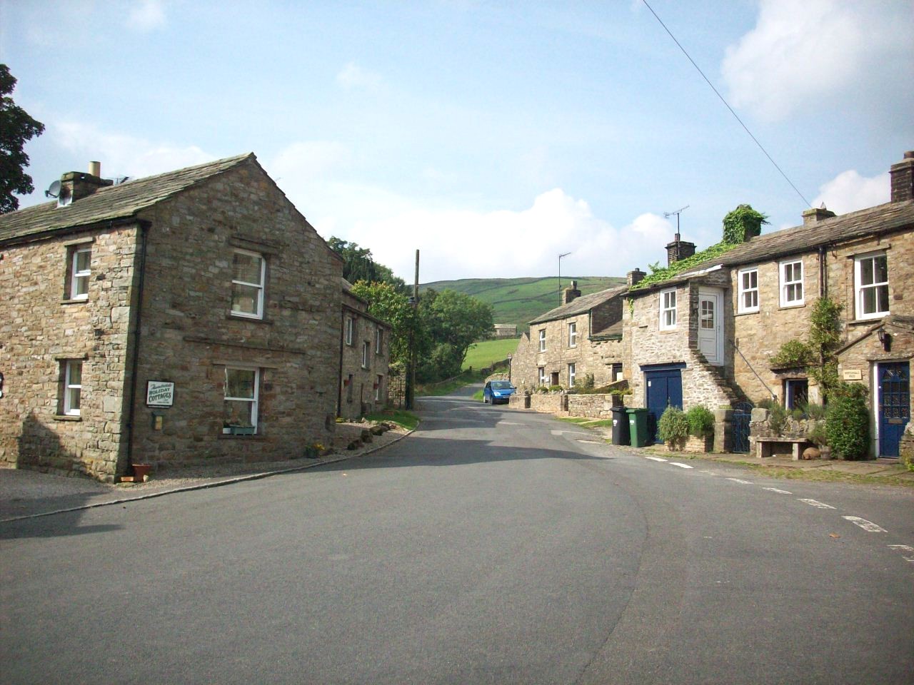
Reeth. The second largest town in the Dale but is now more refered to as the largest village in the Dale and the main tourist centre.

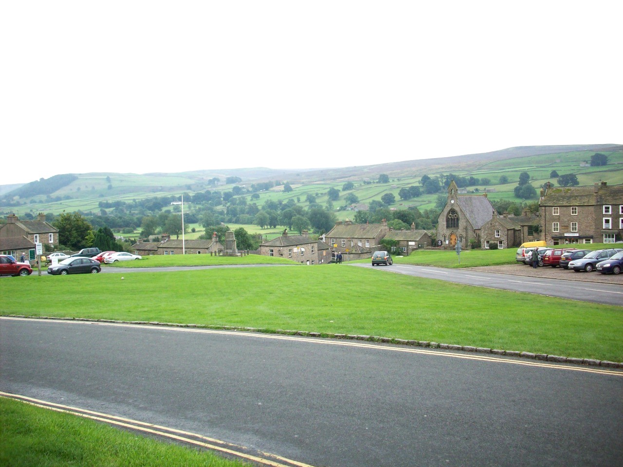
Reeth. Noted to have one of the loveliest village greens and this scene is looking south towards Grinton and Harkerside Moor.

Arkengarthdale. The most Northerly part of The Yorkshire Dales and North Yorkshire itself and this scene is looking north west towards Langthwaite.

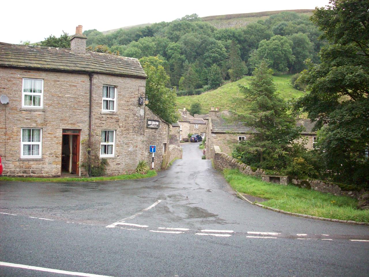
Langthwaite. Lovely isolated village situated in Arkengarthdale and famous for The James Herriot TV series, All Creatures Great And Small.

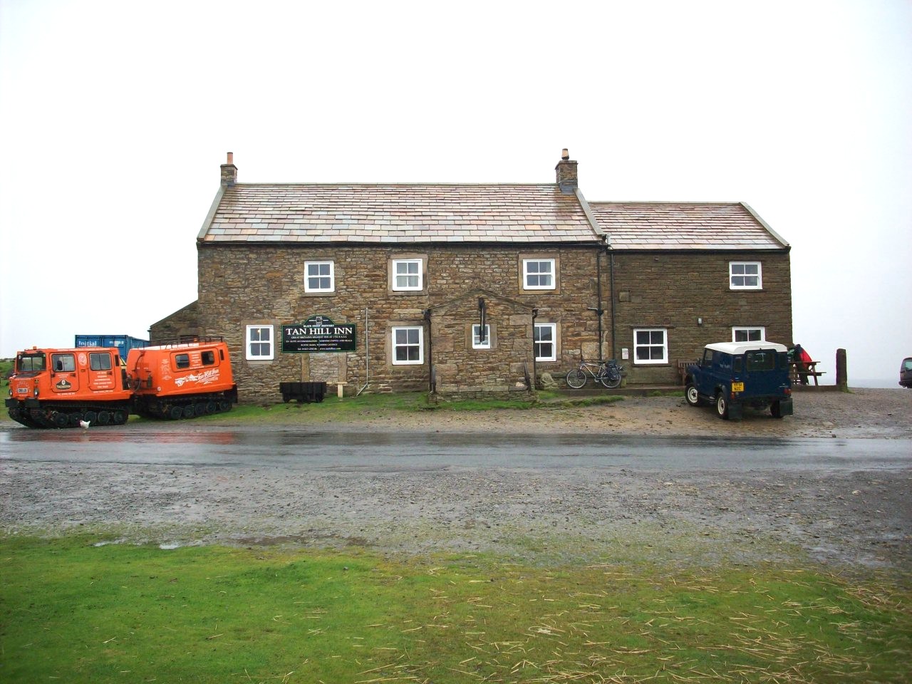
The Tan Inn. England's highest public house, Situated 1732 feet above sea level about 5 miles north of Keld, On the Pennine Way.

Swaledale. This is the most remote and westerly section of this Dale where it meets with Whitsun Dale Beck and Birkdale, About 2 miles west of Keld.

Swaledale. This location is about 1 mile west of Keld, Looking east towards West Stonesdale and is one of the most scenic part of this Dale.

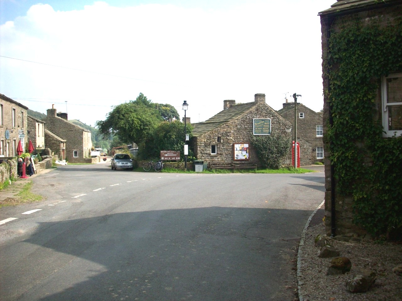
Keld Village. A small Viking-origin settlement and is situated in the upper part of Swaledale, On The Pennine Way and Coast To Coast Walk.

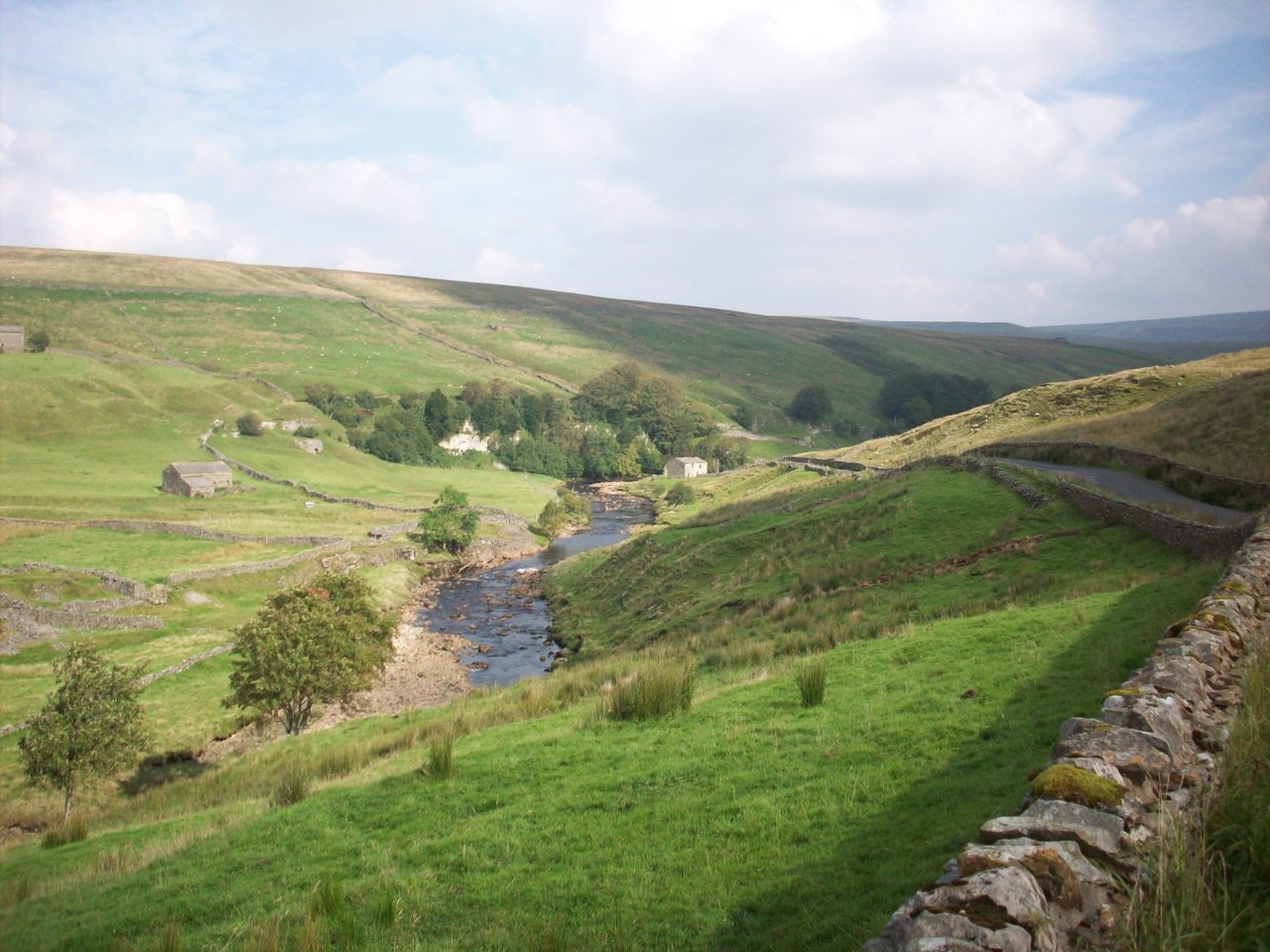
Swaledale. This location is in Keld Village, Looking north east towards Kesdon Force and East Stonesdale.

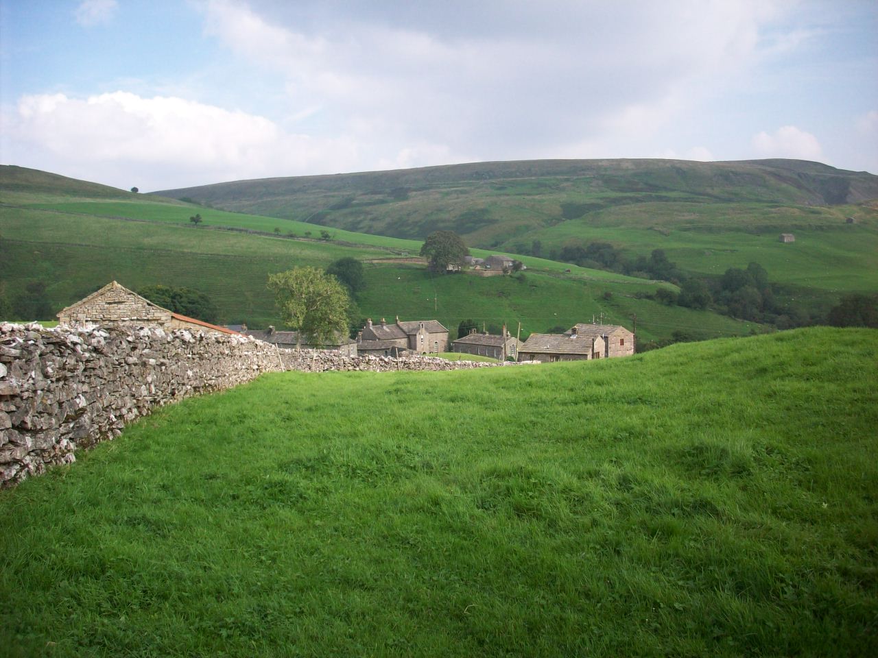
Thwaite. Another of Swaledales lovely villages with its handsome graystone cottages. situated about 2 miles south east of Keld.

Thwaite. Another scene of this Swaledale village and the birthplace of famous naturalists Richard and Cherry Keaton.

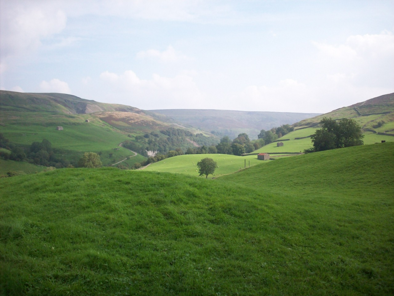
Thwaite. The last scene of this village, Looking into it from the south east direction. Taken before my climb over Buttertubbs Pass into Wensleydale.

My approach over Buttertubbs Pass. A high scenic road that links Upper Swaledale with Wensleydale.

East Cumbria. This scene is on the B6270 on my departure into Swaledale and is looking west from Nateby Common towards the beautiful Eden Valley.

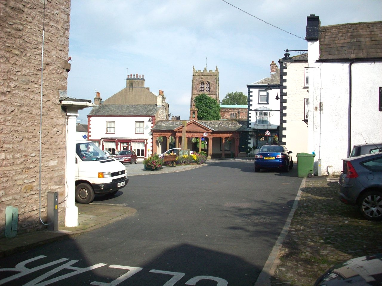
Kirkby Stephen. Situated in East Cumbria at the head of the Eden Valley and is a lovely little market town, Ideal for a good rest stop.

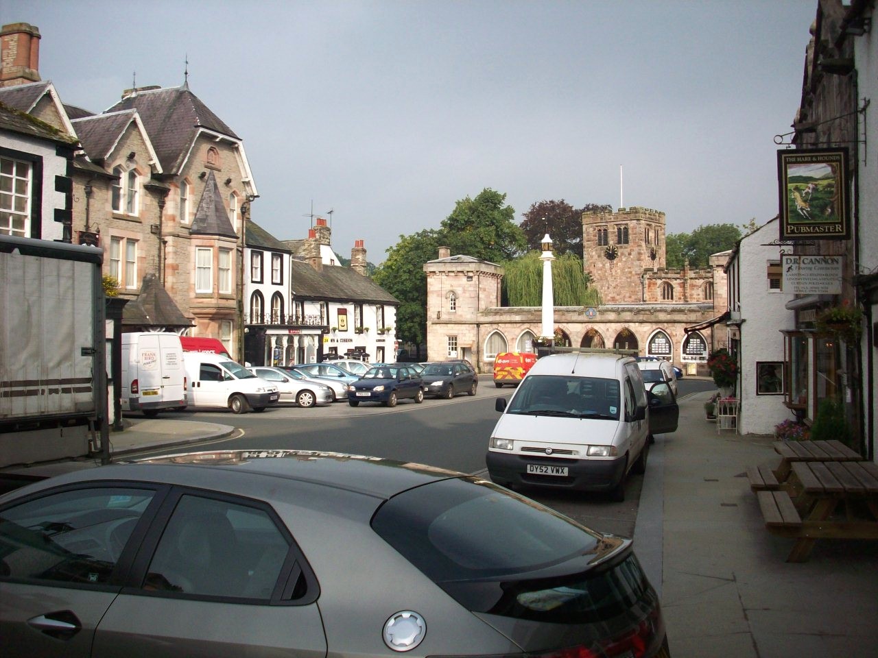
Appleby In Westmorland. Another East Cumbria Market town situated in The Eden Valley and this scene is in centre looking towards St Lawence's Church.

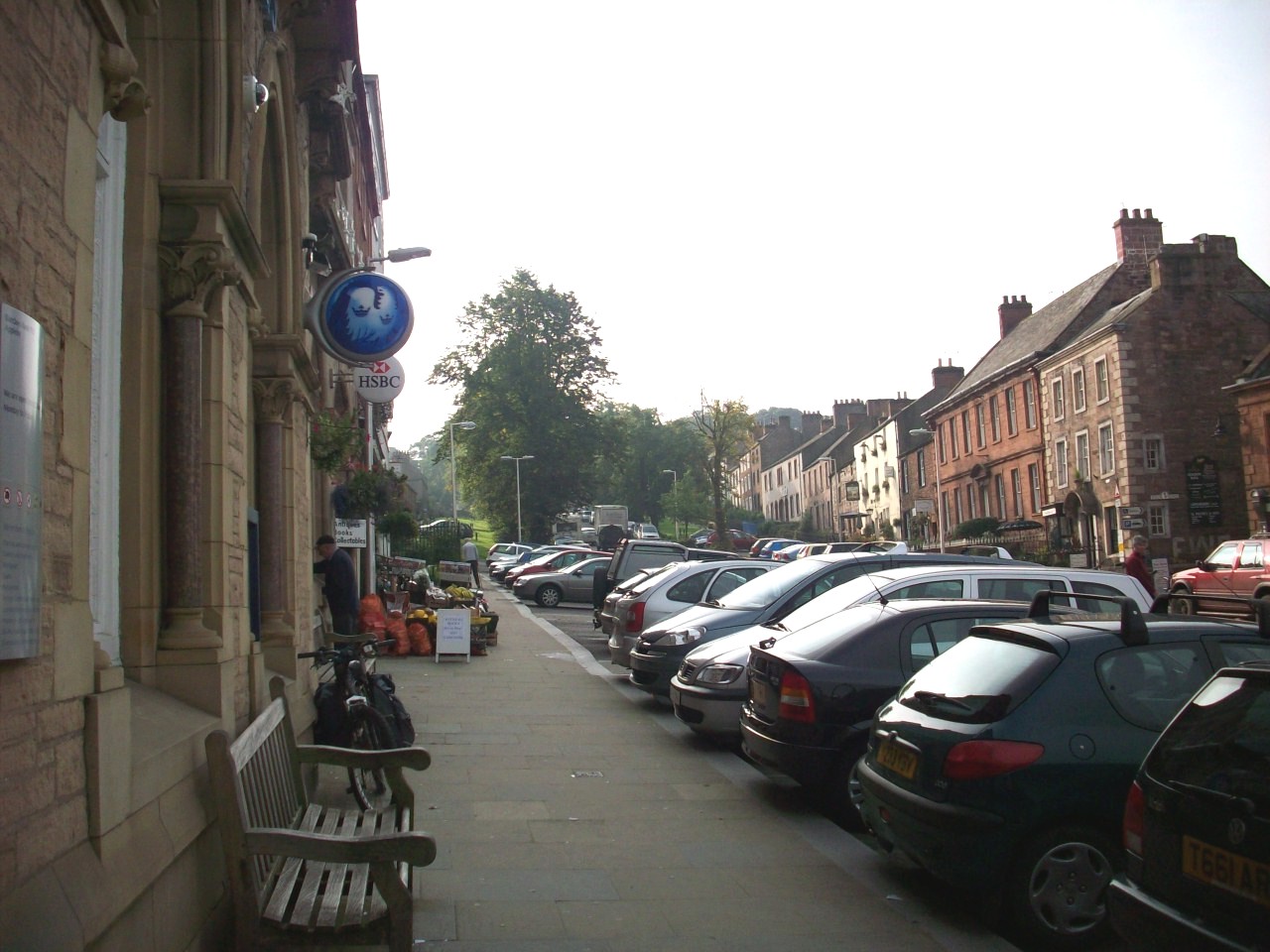
Appleby In Westmorland. Another scene of this lovely North Pennine Town. This is looking up Boroughgate towards the Castle area

Dufton. Situated about 4 miles North of Appleby at the foot of The North Pennines and still has a Youth Hostal. An Ideal link cycle route to Scotland

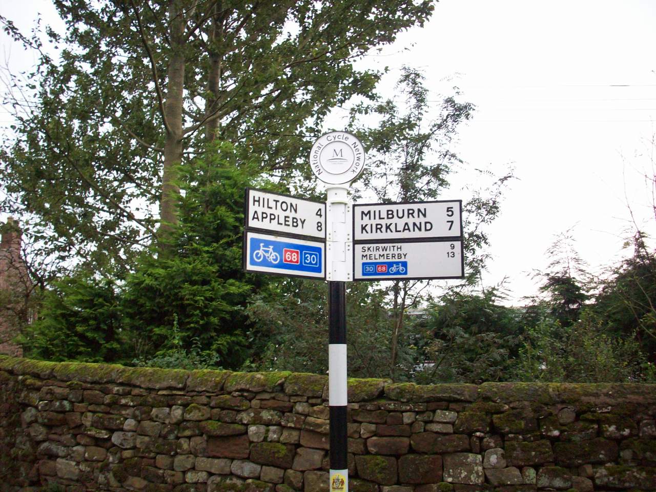
Dufton. This is on the Pennine cycleway, Route number 68 and this is the milepost showing you the distance between the local towns and villages.

Dufton Pike. Located about a mile north of Dufton village and by The Pennine Way to Alston. England's highest market town.

Dufton. This is on the Pennine Way, The route to Langdon Beck in Teesdale and this scene is on the start of my walk up to High Cup Nick.

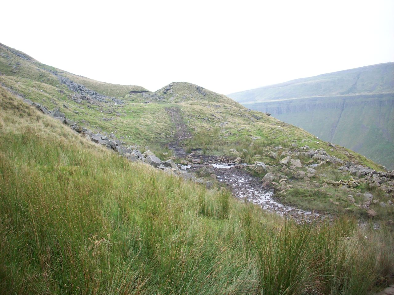
High Cup Nick. One of the highest fells in the North Pennines and on a clear day they are spectacular views towards the Lake District and Beyond.

High Cup Gill. A spectacular steep sided gorge that runs into Troutbeck and eventuely feeds The Edon at Kirkby Thore.

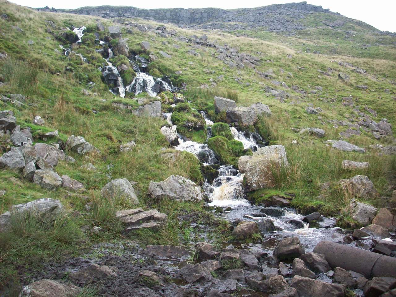
High Cup Nick. This location is looking towards the sumit and this scene is one of the waterfalls that feeds High Cup Gill.

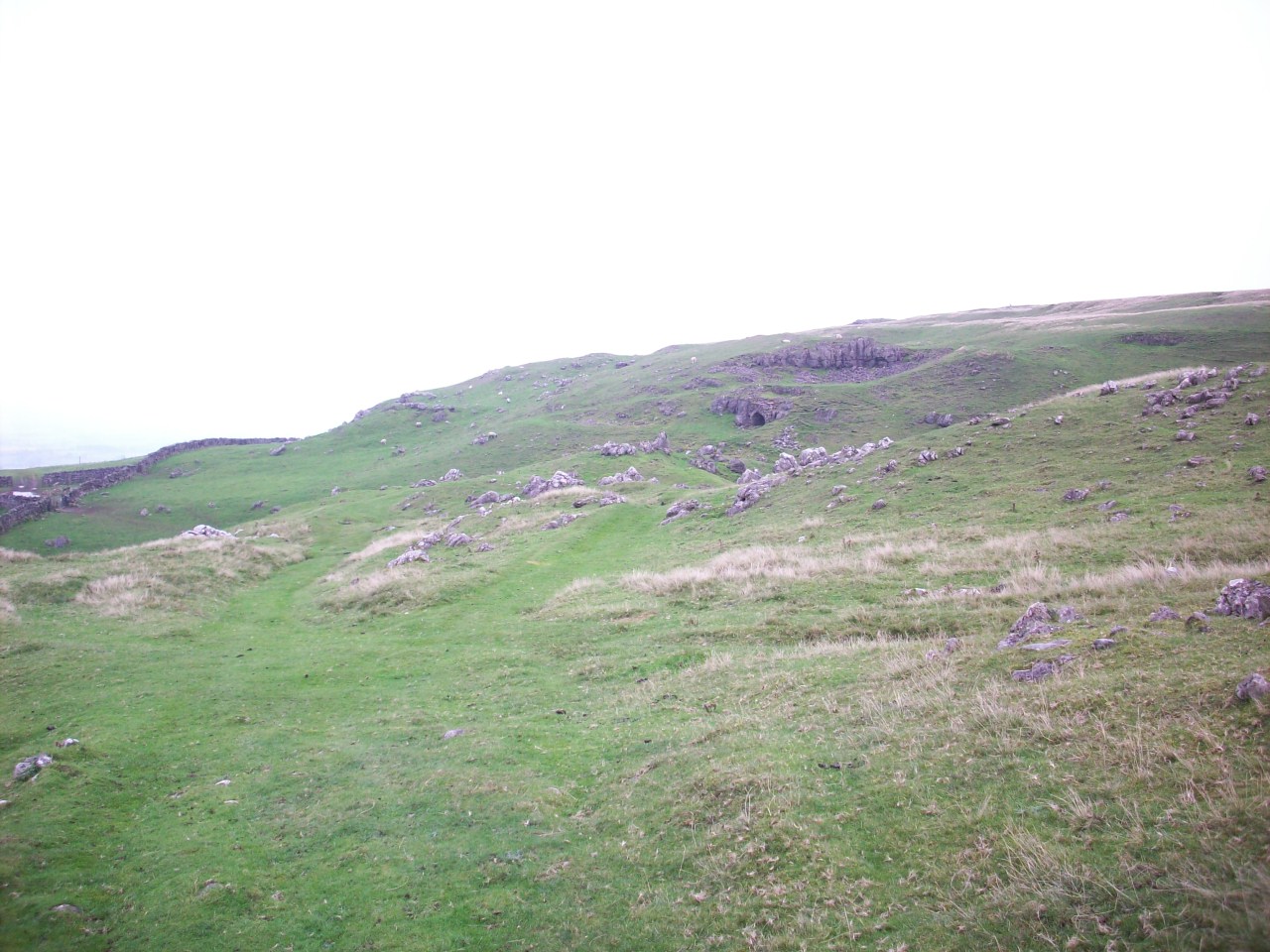
This location is looking towards Backstone Edge, A similar limestone scene to Malham, In the southern part of The Yorkshire Dales.

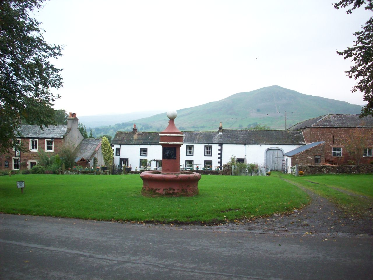
The Cumbria village of Nateby situated 1 mile south of Kirkby Stephen and is the Gateway to Swaledale. Taken during my route back from Scotland.

Please left click on selected picture to enlarge image.


Links To My Other Cycle Touring Pages Relating To The Yorkshire Dales

Home Page

Pictures From My Cycle Tour Of The Eastern Dales Featuring Highlights Of The Beryl Burton Cycle Route

Pictures From Cycle Tour Of The Western Dales

Pictures From My Cycle Trail Of The Nidderdale Greenway


Links to my UK Cycle Touring Pages From https://www.philsonlinephotosite.co.uk

Photographs From My Cycle Tours During The 1980s

Pictures From My Cycle Tour Of Scotland

Pictures From My Cycle Tours Of The North York Moors And East Coast

Pictures From My Cycle Tour Of East Yorkshire Featuring The Trans Pennine Trail

Pictures From My Cycle Tour To North Wales From Harrogate Via The Trans Pennine Trail

Pictures From My Cycle Tour Of Lancashire Featuring Morecambe Bay And The Forest Of Bowland

Pictures From My Cycle Tour Of Cumbria Featuring The North Pennines And Lake District

Pictures From My Cycle Tours Of South East England


Links To My Cycling Videos Related To The Dales

Full Footage Of My 2016 Great Yorkshire Cycle Tour - YouTube Includes footage of the Swaledale villages of Grinton And Reeth


Site Navigation Map Of All My Web Links

mailto:philip@philsnidderdalesite.co.uk